Niagara Reservation

Why it's listed
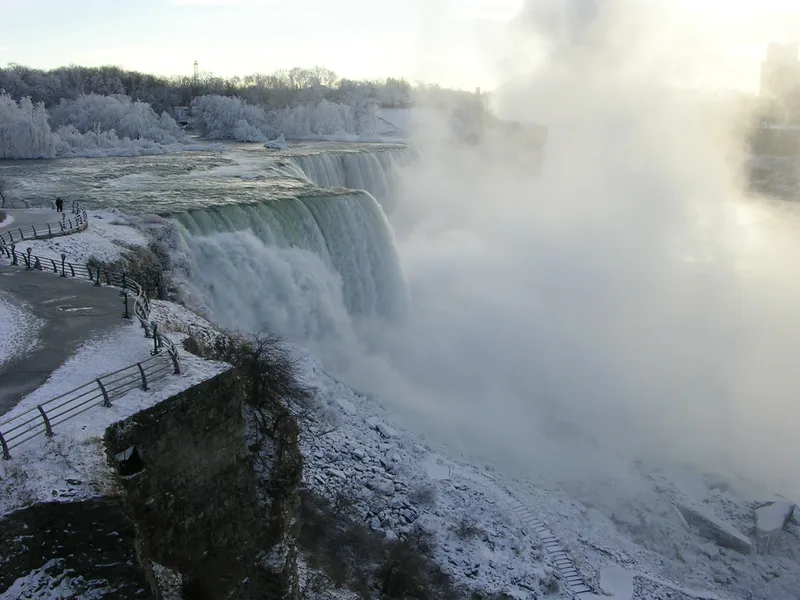
Niagara Reservation is a state-owned park along the eastern bank of the Niagara River in Niagara Falls, New York. It covers about 435 acres, taking in a narrow shoreline strip at the American Falls and a group of islands, the largest being Goat Island, linked to shore by bridges. The park exists because New York acted in 1885 to protect the falls from factories, hotels and signs that had crowded the shoreline. A campaign backed by figures such as Frederick Law Olmsted, Henry James and Frederic Edwin Church led to legislation signed by Governor Grover Cleveland in 1883 and a $1,000,000 bond issue in 1885. New York became the first state to use eminent domain for esthetic purposes. The state removed about 150 buildings, and Olmsted and Calvert Vaux carried out a plan in 1887 that kept construction minimal. The Robert Moses Parkway, finished in 1960, is the main modern intrusion.
Significance in brief: The reservation was the first case of a state using eminent domain to acquire land for esthetic purposes, setting a precedent other states followed. After its creation the state removed about 150 buildings and all raceways and flumes so the falls could be seen in a natural setting. Its landscape follows the plan of Frederick Law Olmsted and Calvert Vaux.
Machine-generated summary. This summary was generated by a language model from the official nomination document and has not been reviewed line by line by an editor. It may contain errors. Check the source document before relying on any detail. Source: nomination document (PDF) · National Archives catalog entry. NRHP reference 66000555, listed October 15, 1966. Summary generated October 2026 (model claude-sonnet-5-5, prompt v1.0-2026-10-29, confidence medium).
Key facts
| Address | Niagara Reservation, Niagara Falls |
|---|---|
| County | Niagara County |
| Listed | October 15, 1966 |
| Reference number | 66000555 |
| Resource type | Site |
| Period of significance | 1885 |
| Architect / builder | Frederick Law Olmsted and Calvert Vaux (landscape plan implemented 1887) |
| Areas of significance | Conservation |
| Level of significance | National |
| National Historic Landmark | Yes, designated May 23, 1963 |
| Status (as stated in the nomination) | Listed as occupied and in good condition; the administration building from 1900 is still in use, and the Robert Moses Parkway (1960) is noted as an intrusion. |
| Acreage | 435 |
| Coordinates | 43.08155, -79.06734 (NPS GIS) |
What listing means for this property
Sites (archaeological sites, battlefields, landscapes) are often listed with a restricted address to protect them from looting or disturbance. Listing is honorary for private owners; federal undertakings on or near the site go through Section 106 review, and state laws may protect burials and artefacts regardless of listing.
General information, not legal or tax advice. Rules change; confirm with your State Historic Preservation Office or a qualified adviser.
Sources and further reading
- National Park Service, National Register of Historic Places database (snapshot May 2026), reference 66000555.
- Nomination form (PDF, National Archives) — catalog entry
- Wikipedia article (used for cross-checking only; text not reproduced here)
- Wikidata Q1031716
- This listing as JSON
Last updated October 2026. Found an error? See the editorial policy for how to report it.