Lower East Side Historic District (Boundary Increase)

Why it's listed
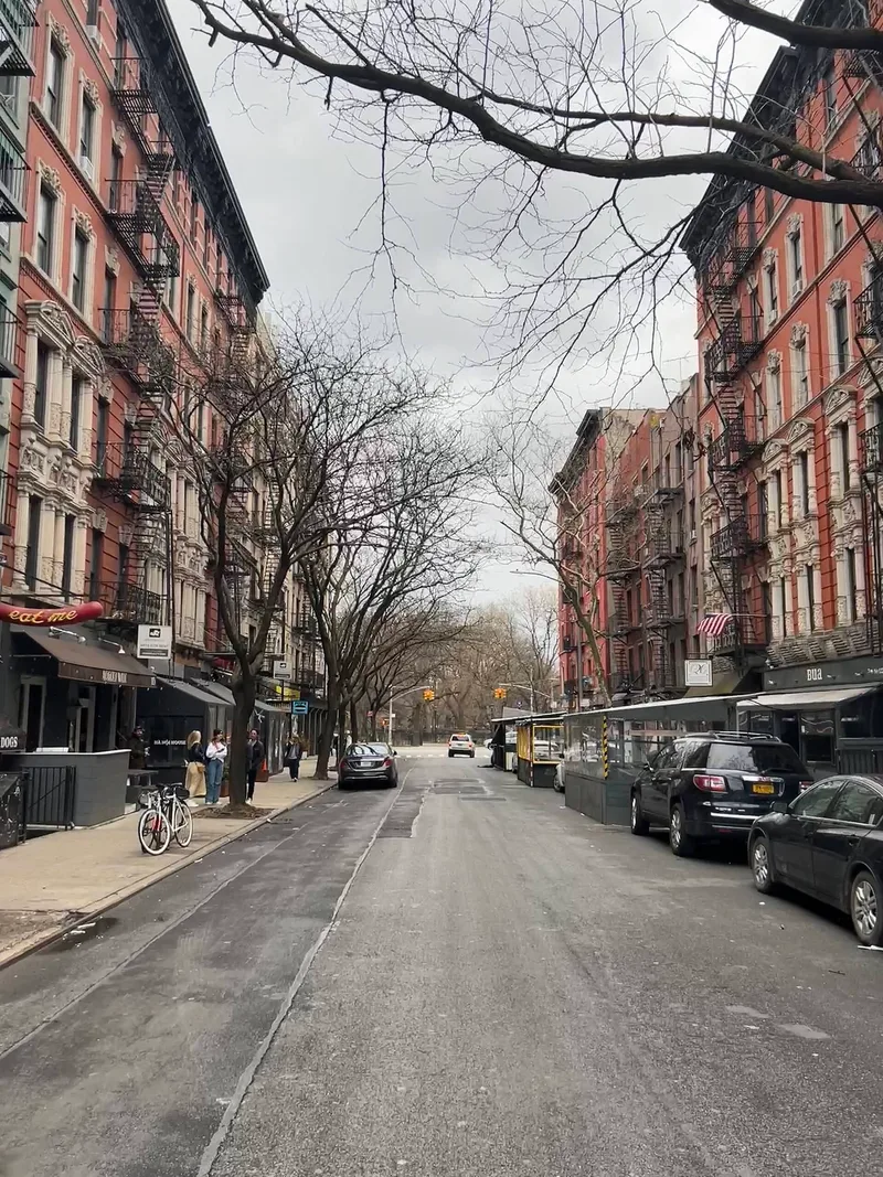
This expansion of the Lower East Side Historic District adds all or part of 11 blocks south of the original boundary in Manhattan. It holds 108 newly contributing buildings, mainly five- and six-story tenements mixed with three- and four-story early-19th-century houses that were raised and converted as the area changed. The land was once part of the Rutgers family estate, and the blocks were laid out before the 1811 street grid, which gives them a different orientation from the rest of Manhattan. The architecture ranges from Federal and Greek Revival to Italianate, Queen Anne, Neo-Grec and Beaux-Arts. All Saints Church, attributed to John Heath, dates from 1827-9. Two Depression-era housing complexes, Amalgamated Dwellings (1930) and Vladeck Houses (1939-40), show the shift toward cooperative and public housing. The area is significant because much of the southern Lower East Side was cleared in the 1930s and later, leaving these blocks as the surviving record of the neighborhood's immigrant history and its affordable housing.
Significance in brief: The area preserves the southern remnants of the historic Lower East Side, which survived slum clearance that removed tenements nearer the East River. It contains rows of tenements and converted early-19th-century houses showing the neighborhood's shift from single-family homes to immigrant housing. Amalgamated Dwellings and Vladeck Houses illustrate the move toward cooperative and public housing in the Depression era.
Machine-generated summary. This summary was generated by a language model from the official nomination document and has not been reviewed line by line by an editor. It may contain errors. Check the source document before relying on any detail. Source: nomination document (PDF) · National Archives catalog entry. NRHP reference 04000297, listed May 2, 2006. Summary generated October 2026 (model claude-sonnet-5-5, prompt v1.0-2026-10-29, confidence medium).
Key facts
| Address | Roughly along Division, Rutger, Madison, Henry, Grand Sts., New York |
|---|---|
| County | Manhattan |
| Listed | May 2, 2006 |
| Reference number | 04000297 |
| Resource type | District |
| Period of significance | early nineteenth century through 1940 |
| Architect / builder | Many architects named, including Ernst W. Gries, John Heath (attributed, All Saints Church), Renwick, Aspinwall & Russell, Herter Brothers, Schickel & Ditmars, and Shreve, Lamb and Harmon |
| Architectural style | Federal, Greek Revival, Italianate, Queen Anne, Neo-Grec, Romanesque Revival, Beaux-Arts, Italian Renaissance Revival, Art Deco |
| Areas of significance | Architecture, Black, Social History, Religion, European |
| Level of significance | National, Local |
| Status (as stated in the nomination) | 108 contributing and 25 noncontributing buildings; current functions remain residential, commercial, religious, educational and postal. |
| Acreage | 32 |
| Coordinates | 40.71330, -73.98806 (NPS GIS) |
What listing means for this property
This is a historic district. Buildings within its boundary are either contributing (they add to the district's significance) or non-contributing. Owners of contributing income-producing buildings can claim the 20% federal rehabilitation tax credit; homeowners should look at state credits. National Register districts impose no design review by themselves; a local historic district ordinance, if one exists, does (the difference explained).
General information, not legal or tax advice. Rules change; confirm with your State Historic Preservation Office or a qualified adviser.
Sources and further reading
- National Park Service, National Register of Historic Places database (snapshot May 2026), reference 04000297.
- Nomination form (PDF, National Archives) — catalog entry
- Wikidata Q111360588
- This listing as JSON
Last updated October 2026. Found an error? See the editorial policy for how to report it.