Fort Ticonderoga
Also known as: See Also:Mount Independence

Why it's listed
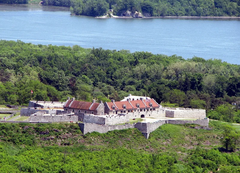
Fort Ticonderoga occupies a rocky promontory where Ticonderoga Creek meets Lake Champlain, near the north end of Lake George. The French began building it as Fort Carillon in 1755, using a Vauban-style plan with four corner bastions, two demi-lunes, and stone barracks around a sunken parade ground. The site controlled the route between Canada and the Hudson Valley. Montcalm's French force repulsed a large British attack in 1758, but General Amherst captured the fort in 1759. Ethan Allen and the Green Mountain Boys took it in 1775, and cannon from the fort were later hauled to the siege of Boston. In 1777 Burgoyne placed artillery on Mount Defiance, and the Americans evacuated. The fort fell into ruin until Stephen Pell began reconstruction in 1908 on the original foundations. Today it serves as a museum, with French outer lines, a trader's village site, and the Jardin du Roi nearby.
Significance in brief: Located at the junction of Lake Champlain and Lake George, the fort was the key to Canada and the Hudson Valley from 1755 to 1777 and saw more of the English-French and American-English struggles than any other post. It is described as the finest reconstructed example of an advanced 18th-century European-design fortress in the United States.
Machine-generated summary. This summary was generated by a language model from the official nomination document and has not been reviewed line by line by an editor. It may contain errors. Check the source document before relying on any detail. Source: nomination document (PDF) · National Archives catalog entry. NRHP reference 66000519, listed October 15, 1966. Summary generated October 2026 (model claude-sonnet-5-5, prompt v1.0-2026-10-29, confidence medium).
Key facts
| Address | 2.5 mi. S of Ticonderoga on NY 22, Ticonderoga |
|---|---|
| County | Essex County |
| Listed | October 15, 1966 |
| Reference number | 66000519 |
| Resource type | District |
| Period of significance | 1755-1757 |
| Architect / builder | Marquis de Lotbiniere (Michel Chartier) |
| Architectural style | Fortress based on the designs of Vauban, adapted to the rocky ridge |
| Areas of significance | Historic - Non-Aboriginal, Economics, Military |
| Level of significance | National |
| National Historic Landmark | Yes, designated November 28, 1972 |
| Status (as stated in the nomination) | Restored beginning in 1908 and used as offices, museum and display areas; owned and administered by the Fort Ticonderoga Association. |
| Acreage | 2195 |
| Coordinates | 43.84211, -73.38746 (NPS GIS) |
What listing means for this property
This is a historic district. Buildings within its boundary are either contributing (they add to the district's significance) or non-contributing. Owners of contributing income-producing buildings can claim the 20% federal rehabilitation tax credit; homeowners should look at state credits. National Register districts impose no design review by themselves; a local historic district ordinance, if one exists, does (the difference explained).
General information, not legal or tax advice. Rules change; confirm with your State Historic Preservation Office or a qualified adviser.
Sources and further reading
- National Park Service, National Register of Historic Places database (snapshot May 2026), reference 66000519.
- Nomination form (PDF, National Archives) — catalog entry
- Wikipedia article (used for cross-checking only; text not reproduced here)
- Wikidata Q1438776
- This listing as JSON
Last updated October 2026. Found an error? See the editorial policy for how to report it.