Elmendorph Inn

Why it's listed
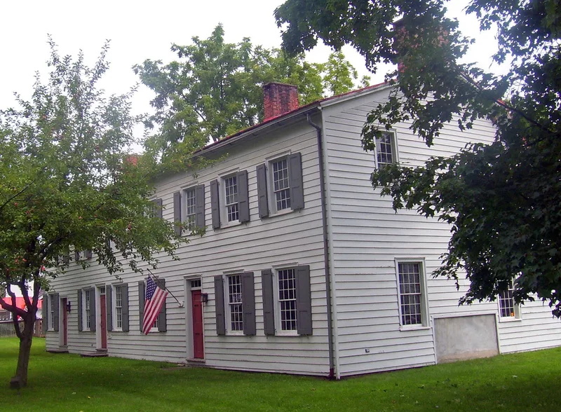
Standing on a half-acre corner lot beside Route 9 in Red Hook, this two-story frame building began about 1750 as a house and tavern. It has a modified gambrel roof, clapboard siding now covered with asphalt shingles, and four chimneys. After 1783 a southern addition increased its size by half, and further changes were made before 1830. Inside, plaster walls, wide plank floors, heavy oak beams and Federal-period mantels with carved sunbursts survive. A 1797 map labels it Elmendorph's Inn, and by 1811 it was known as Loop's Hotel. From 1815 the town board met there regularly until 1842. In the nineteenth century it was divided into apartments, and a kindergarten operated in it in the 1890s. It served as a residence for the first half of the twentieth century. It is considered the oldest building in the village and the only surviving gambrel-roofed structure there. A local group acquired it with plans to restore it.
Significance in brief: The nomination calls it a rare surviving eighteenth-century residence and tavern in the region. It is the oldest building in the village of Red Hook and the only surviving gambrel-roofed structure there. It also hosted town government meetings for more than twenty-five years.
Machine-generated summary. This summary was generated by a language model from the official nomination document and has not been reviewed line by line by an editor. It may contain errors. Check the source document before relying on any detail. Source: nomination document (PDF) · National Archives catalog entry. NRHP reference 78001850, listed September 20, 1978. Summary generated October 2026 (model claude-sonnet-5-5, prompt v1.0-2026-10-29, confidence medium).
Key facts
| Address | 43--45 N. Broadway, Red Hook |
|---|---|
| County | Dutchess County |
| Listed | September 20, 1978 |
| Reference number | 78001850 |
| Resource type | Building |
| Period of significance | c. 1750, 1800 |
| Areas of significance | Exploration/Settlement, Politics/Government, Architecture |
| Level of significance | Local |
| Status (as stated in the nomination) | Unrestored; sold in 1966 and left vacant until purchased by a local group planning restoration; the form lists status as work in progress and unoccupied. |
| Acreage | 0.5 |
| Coordinates | 41.99725, -73.87382 (NPS GIS) |
What listing means for this property
For an income-producing building, listing (individually or as a contributing building in a district) is the gateway to the 20% federal rehabilitation tax credit on qualified rehabilitation costs, often stackable with state credits. Work claiming the credit must follow the Secretary of the Interior's Standards and be approved in advance.
Listing does not restrict a private owner acting without federal money or permits; where federal funding or licensing is involved, Section 106 review applies.
General information, not legal or tax advice. Rules change; confirm with your State Historic Preservation Office or a qualified adviser.
Sources and further reading
- National Park Service, National Register of Historic Places database (snapshot May 2026), reference 78001850.
- Nomination form (PDF, National Archives) — catalog entry
- Wikipedia article (used for cross-checking only; text not reproduced here)
- Wikidata Q1332899
- This listing as JSON
Last updated October 2026. Found an error? See the editorial policy for how to report it.