Greenpoint Historic District

Why it's listed
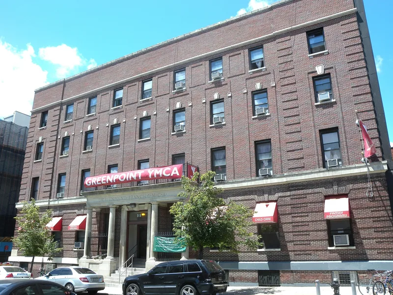
Greenpoint Historic District covers eleven blocks of northern Brooklyn, a neighborhood that grew in the mid-nineteenth century alongside industry on the waterfront. Its streets hold substantial rowhouses built for factory owners and managers, more modest rowhouses and walk-up flathouses for laborers, plus shops, banks and six churches. Italianate houses with high stoops and bracketed cornices dominate, joined by Anglo-Italianate, Second Empire, neo-Grec and Queen Anne buildings, and by neo-Classical banks of 1895 and 1906. Unlike many Brooklyn areas, where developers built long rows for resale to commuters, most Greenpoint buildings were commissioned individually by owners and builders for people who worked nearby. The district was listed because it preserves this distinctive pattern of industrial-era residential life and keeps an unusually high level of architectural integrity. Streets still show vistas little changed since the turn of the century, with only seventeen intrusions among its buildings.
Significance in brief: The nomination argues the district is an intact nineteenth-century neighborhood closely tied to Brooklyn's waterfront industry. It housed owners, managers and laborers who worked nearby rather than commuters, and most buildings were put up individually by owners and builders rather than by speculative developers. It also retains an outstanding level of architectural integrity.
Machine-generated summary. This summary was generated by a language model from the official nomination document and has not been reviewed line by line by an editor. It may contain errors. Check the source document before relying on any detail. Source: nomination document (PDF) · National Archives catalog entry. NRHP reference 83001692, listed September 26, 1983. Summary generated October 2026 (model claude-sonnet-5-5, prompt v1.0-2026-10-29, confidence medium).
Key facts
| Address | Roughly bounded by Kent, Calyer, Noble, and Franklin Sts., Clifford Pl. and Manhattan Ave., New York |
|---|---|
| County | Brooklyn |
| Listed | September 26, 1983 |
| Reference number | 83001692 |
| Resource type | District |
| Period of significance | 1850's-1930 |
| Architect / builder | various |
| Architectural style | Italianate, Anglo-Italianate, French Second Empire, neo-Grec, Queen Anne, Gothic Revival and neo-Classical |
| Areas of significance | Architecture |
| Level of significance | Local |
| Status (as stated in the nomination) | Described as largely unchanged since its development, with 17 intrusions; occupied, with private residential, commercial and religious uses. |
| Acreage | 43 |
| Coordinates | 40.72929, -73.95527 (NPS GIS) |
What listing means for this property
This is a historic district. Buildings within its boundary are either contributing (they add to the district's significance) or non-contributing. Owners of contributing income-producing buildings can claim the 20% federal rehabilitation tax credit; homeowners should look at state credits. National Register districts impose no design review by themselves; a local historic district ordinance, if one exists, does (the difference explained).
General information, not legal or tax advice. Rules change; confirm with your State Historic Preservation Office or a qualified adviser.
Sources and further reading
- National Park Service, National Register of Historic Places database (snapshot May 2026), reference 83001692.
- Nomination form (PDF, National Archives) — catalog entry
- Wikipedia article (used for cross-checking only; text not reproduced here)
- Wikidata Q5604394
- This listing as JSON
Last updated October 2026. Found an error? See the editorial policy for how to report it.