Freegrace Marble Farm Historic District
Also known as: Dona Farm

Why it's listed
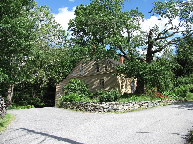
Marble Farm is a 63-acre working landscape in northeastern Sutton, Massachusetts, centered on the intersection of Burbank and Sibley Roads. It includes a clapboarded farmhouse probably rebuilt in the last quarter of the 18th century, a barn, an equipment shed and a smaller barn, all likely 19th century. Stone walls mark fields that follow changes in soil type, and a private cemetery holds about thirty stones, including those of Marble descendants. Freegrace Marble founded the farm, and his son Malachi owned it in the late 1700s. Later owners included Oliver Leland, who bought it in 1827, and the Leland family until 1895. The farm reflects changing local agriculture, from subsistence farming to commercial dairying and part-time farming in the 20th century. The house shows evidence of an earlier house on the site, and the grounds may hold prehistoric and early historic archaeological remains, including the sites of a demolished house, stockade and distillery.
Significance in brief: The farm was founded by Freegrace Marble and shows Sutton's agricultural development from subsistence farming through commercial dairying and part-time farming. Its farmhouse, outbuilding cluster, field patterns and Marble family cemetery survive, and the property has archaeological potential, including possible prehistoric and early historic remains.
Machine-generated summary. This summary was generated by a language model from the official nomination document and has not been reviewed line by line by an editor. It may contain errors. Check the source document before relying on any detail. Source: nomination document (PDF) · National Archives catalog entry. NRHP reference 89001967, listed November 13, 1989. Summary generated October 2026 (model claude-sonnet-5-5, prompt v1.0-2026-10-29, confidence medium).
Key facts
| Address | 80 Burbank Rd., Sutton |
|---|---|
| County | Worcester County |
| Listed | November 13, 1989 |
| Reference number | 89001967 |
| Resource type | District |
| Architectural style | Early Republic/Federal; No Style (vernacular farmhouse) |
| Criteria |
|
| Areas of significance | Agriculture, Exploration/Settlement, Architecture |
| Level of significance | Local |
| Status (as stated in the nomination) | Currently used for haying and lumbering; the farmhouse and outbuildings remain extant. |
| Acreage | 63 |
| Coordinates | 42.16274, -71.74993 (NPS GIS) |
What listing means for this property
This is a historic district. Buildings within its boundary are either contributing (they add to the district's significance) or non-contributing. Owners of contributing income-producing buildings can claim the 20% federal rehabilitation tax credit; homeowners should look at state credits. National Register districts impose no design review by themselves; a local historic district ordinance, if one exists, does (the difference explained).
General information, not legal or tax advice. Rules change; confirm with your State Historic Preservation Office or a qualified adviser.
Sources and further reading
- National Park Service, National Register of Historic Places database (snapshot May 2026), reference 89001967.
- Nomination form (PDF, National Archives) — catalog entry
- Wikipedia article (used for cross-checking only; text not reproduced here)
- Wikidata Q5500886
- This listing as JSON
Last updated October 2026. Found an error? See the editorial policy for how to report it.