Sutton Center Historic District

Why it's listed
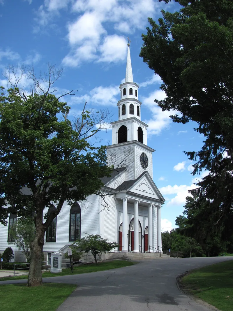
Sutton Center is the historic village core of Sutton, about twelve miles south of Worcester, Massachusetts. The district covers roughly 435 acres arranged around the crossing of Boston Road, Uxbridge Road and Singletary Avenue. Civic buildings cluster on the south side: the 1829 Congregational Meeting House, the 1719 Town Common, a 1982 Town Hall and the 1719 Center Burying Ground. A small commercial area to the north includes the 1839 Federal style Brick Block and a blacksmith shop. Beyond the center lie single-family houses and farmhouses with ample yards, barns, orchards and pastures. Most buildings are wooden and date from the 18th and 19th centuries, chiefly Federal or Greek Revival in style, including several two-story pre-Revolutionary houses. Large old maples line the streets, and some fields are still hayed or planted with corn. The district was listed because it keeps the layout and character of a 19th century rural New England village, with 121 contributing resources.
Significance in brief: The district preserves the spatial arrangement of a 19th century rural New England village, with civic buildings, a 1719 common and burying ground, a small commercial core and many farmhouses and barns. Its houses, mostly Federal and Greek Revival, show the town center's growth from the pre-Revolutionary period onward. The text mentions civic improvements around 1800-1830, including a school, meetinghouse, powderhouse and hearse house.
Machine-generated summary. This summary was generated by a language model from the official nomination document and has not been reviewed line by line by an editor. It may contain errors. Check the source document before relying on any detail. Source: nomination document (PDF) · National Archives catalog entry. NRHP reference 01000541, listed May 25, 2001. Summary generated October 2026 (model claude-sonnet-5-5, prompt v1.0-2026-10-29, confidence medium).
Key facts
| Address | Roughly Boston Rd., Singletary Ave., and Uxbridge Rd., Sutton |
|---|---|
| County | Worcester County |
| Listed | May 25, 2001 |
| Reference number | 01000541 |
| Resource type | District |
| Architect / builder | William E. Cole (local builder who moved the 'Ocean House' about 1850) |
| Architectural style | Early Republic/Federal; Mid 19th Century/Greek Revival; Late 19th and 20th Century Revivals/Colonial Revival |
| Areas of significance | Architecture, Commerce, Community Planning and Development |
| Level of significance | Local |
| Status (as stated in the nomination) | Still a village center with civic, religious, commercial and residential uses; some small-scale farming continues, with pastures and fields mowed for hay or planted with corn. |
| Acreage | 435 |
| Coordinates | 42.15209, -71.76356 (NPS GIS) |
What listing means for this property
This is a historic district. Buildings within its boundary are either contributing (they add to the district's significance) or non-contributing. Owners of contributing income-producing buildings can claim the 20% federal rehabilitation tax credit; homeowners should look at state credits. National Register districts impose no design review by themselves; a local historic district ordinance, if one exists, does (the difference explained).
General information, not legal or tax advice. Rules change; confirm with your State Historic Preservation Office or a qualified adviser.
Sources and further reading
- National Park Service, National Register of Historic Places database (snapshot May 2026), reference 01000541.
- Nomination form (PDF, National Archives) — catalog entry
- Wikipedia article (used for cross-checking only; text not reproduced here)
- Wikidata Q7650224
- This listing as JSON
Last updated October 2026. Found an error? See the editorial policy for how to report it.