Fisherville Historic District

The pin is a point inside the NPS boundary polygon, not a surveyed location.
Why it's listed
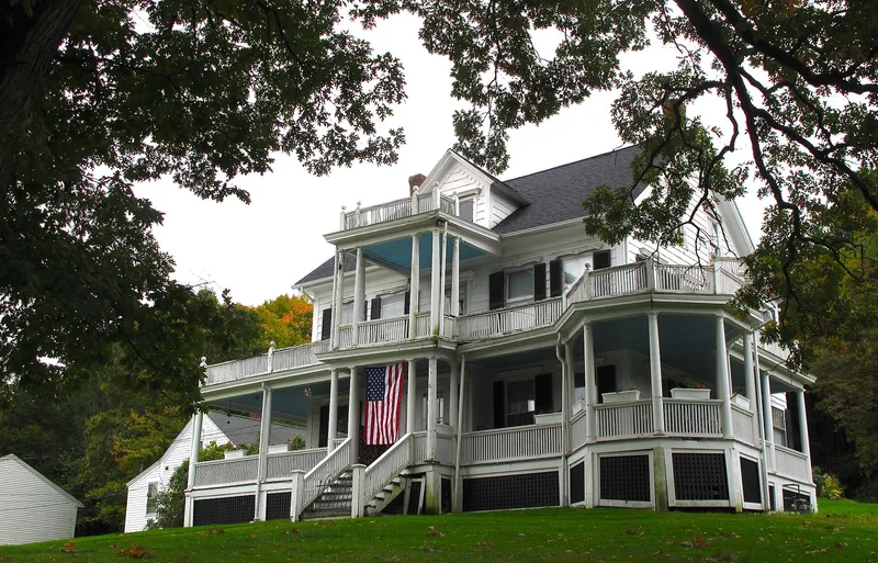
Fisherville is a textile mill village in Grafton, Massachusetts, and its historic district takes in the mill, the streets of company housing and the public buildings that served the community. The village grew around a mill first built in 1830, using water power from Fisherville Pond and the Blackstone Canal of 1828. The brick Fisher Manufacturing Company mill dates mainly from 1888 and 1891, and survives with its office, stock house, electric building, dam and canal remnants. Most housing is vernacular wood-frame construction, much of it two-family houses built by the company between about 1890 and 1915 in identical rows. This reflects the Rhode Island system, which employed whole families. Single-family houses for supervisors and a high-style house for mill owner Erastus Fisher show the social order of the village. Two churches, a library, a club and small shops complete a street pattern that has changed little since about 1910, and the area remains largely residential.
Significance in brief: The district is significant for community planning and development, architecture and industry. It preserves a company-built mill village that grew around the Fisherville Mill, powered by Fisherville Pond and the Blackstone Canal. Its housing, in distinct tiers for workers, supervisors and the owner, reflects the mill company's hierarchy and the Rhode Island system of family employment.
Machine-generated summary. This summary was generated by a language model from the official nomination document and has not been reviewed line by line by an editor. It may contain errors. Check the source document before relying on any detail. Source: nomination document (PDF) · National Archives catalog entry. NRHP reference 96000056, listed February 16, 1996. Summary generated October 2026 (model claude-sonnet-5-5, prompt v1.0-2026-10-29, confidence medium).
Key facts
| Address | Roughly bounded by Main, Elmwood, Ferry and Sampson Sts., Grafton |
|---|---|
| County | Worcester County |
| Listed | February 16, 1996 |
| Reference number | 96000056 |
| Resource type | District |
| Period of significance | 1810-1935 |
| Architectural style | Mid-19th Century/Other: Vernacular; Late 19th & 20th Century Revivals/Other: Vernacular |
| Criteria |
|
| Areas of significance | Industry, Architecture, Community Planning and Development |
| Level of significance | Local |
| Status (as stated in the nomination) | Most buildings remain well preserved and in residential use, with some synthetic siding. Public and institutional buildings are still used for their original purposes. |
| Acreage | 120 |
| Coordinates | 42.17735, -71.69406 (NPS GIS) |
What listing means for this property
This is a historic district. Buildings within its boundary are either contributing (they add to the district's significance) or non-contributing. Owners of contributing income-producing buildings can claim the 20% federal rehabilitation tax credit; homeowners should look at state credits. National Register districts impose no design review by themselves; a local historic district ordinance, if one exists, does (the difference explained).
General information, not legal or tax advice. Rules change; confirm with your State Historic Preservation Office or a qualified adviser.
Sources and further reading
- National Park Service, National Register of Historic Places database (snapshot May 2026), reference 96000056.
- Nomination form (PDF, National Archives) — catalog entry
- Wikipedia article (used for cross-checking only; text not reproduced here)
- Wikidata Q5454957
- This listing as JSON
Last updated October 2026. Found an error? See the editorial policy for how to report it.