Dorchester Park

Why it's listed
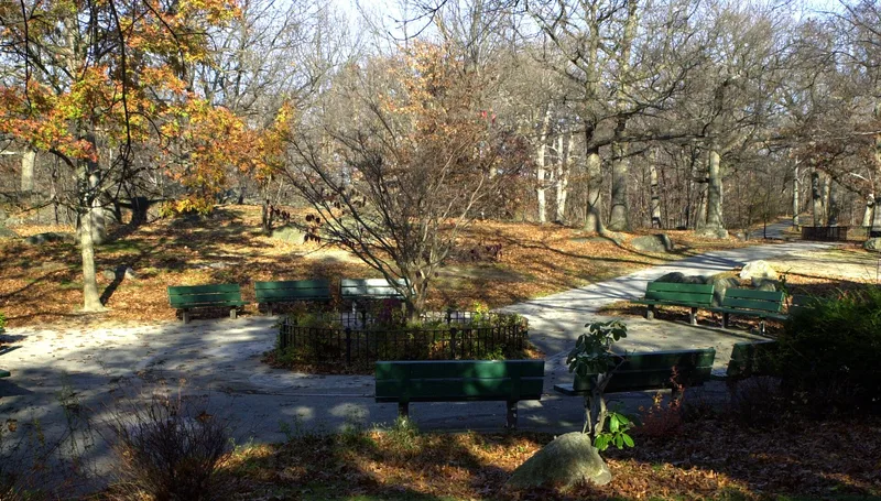
Dorchester Park is a 28.45-acre city park in the Lower Mills section of Dorchester, Boston, laid out beginning in 1891 as part of the Olmsted-designed park system. It was conceived as a natural woodland retreat from the growing city, and it still reads that way: rolling ground, outcrops of Roxbury puddingstone, many oaks, and curving paths that follow the terrain with mowed edges that open views. Built features include granite walls along Dorchester Avenue and Adams Street from 1899, and fieldstone retaining walls added by the WPA in the 1930s beside the baseball field. A sandstone mile marker carved in 1734 is set into the Adams Street wall. Later additions include a playground, tennis courts and a Little League field, which remain subordinate to the woodland. The park is described as well preserved, with particularly high integrity in its western and central woodlands, and it has been in continuous use by neighbors and nearby school children.
Significance in brief: The nomination presents the park as a well-preserved example of the Olmsted firm's naturalistic neighborhood park design, with curvilinear paths, woodland and rock outcrops intended as relief from the city. It also has strong ties to the Dorchester Lower Mills community. A 1734 mile marker set into the Adams Street wall is described as a rare surviving feature of early Dorchester.
Machine-generated summary. This summary was generated by a language model from the official nomination document and has not been reviewed line by line by an editor. It may contain errors. Check the source document before relying on any detail. Source: nomination document (PDF) · National Archives catalog entry. NRHP reference 08000089, listed February 20, 2008. Summary generated October 2026 (model claude-sonnet-5-5, prompt v1.0-2026-10-29, confidence medium).
Key facts
| Address | Bounded by Dorchester Ave., Richmond, Adams & Richview Sts., Boston |
|---|---|
| County | Suffolk County |
| Listed | February 20, 2008 |
| Reference number | 08000089 |
| Resource type | Site |
| Architect / builder | Olmsted firm (Frederick Law Olmsted, Sr.); WPA built the 1930s fieldstone walls |
| Areas of significance | Community Planning and Development, Landscape Architecture |
| Level of significance | Local |
| Status (as stated in the nomination) | Remains in active use as a neighborhood park with woodland, paths, playground, tennis courts and ball fields; the northeastern leg is described as overgrown with some dumping. |
| Acreage | 28.5 |
| Coordinates | 42.27759, -71.06474 (NPS GIS) |
What listing means for this property
Sites (archaeological sites, battlefields, landscapes) are often listed with a restricted address to protect them from looting or disturbance. Listing is honorary for private owners; federal undertakings on or near the site go through Section 106 review, and state laws may protect burials and artefacts regardless of listing.
General information, not legal or tax advice. Rules change; confirm with your State Historic Preservation Office or a qualified adviser.
Sources and further reading
- National Park Service, National Register of Historic Places database (snapshot May 2026), reference 08000089.
- Nomination form (PDF, National Archives) — catalog entry
- Wikipedia article (used for cross-checking only; text not reproduced here)
- Wikidata Q5297616
- This listing as JSON
Last updated October 2026. Found an error? See the editorial policy for how to report it.