Chelsea Garden Cemetery

Why it's listed
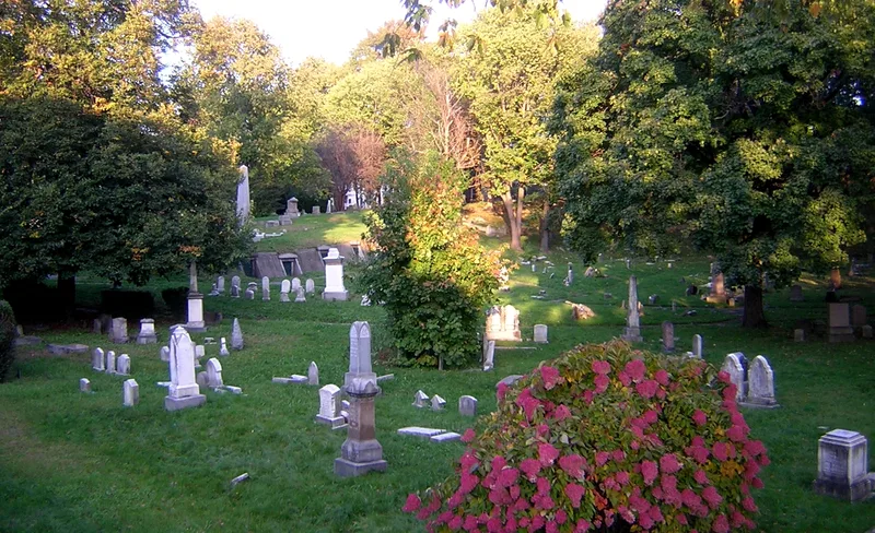
Chelsea Garden Cemetery occupies 3.16 acres of rolling ground on Shawmut Street. It was founded in October 1841 by local residents who wanted a rural-style burial ground like Mount Auburn Cemetery in Cambridge. An 1844 plan survives, showing a curving, naturalistic southern half and a more regular northern half. The Consecration Dell remains, and the outline of the Garden Pond, filled in during the late 19th century, can still be traced. The grounds hold slab, tablet and obelisk markers, a rare zinc monument, sailors' cenotaphs, and eight hillside tombs built between 1843 and 1861. The Soldiers' Plot, arranged in an ellipse with a cannon, was dedicated on May 30, 1868. A 1908 fire destroyed the surrounding neighborhood and many cemetery records, but the cemetery survived. Cemetery records show over 10,000 burials between 1841 and 1980, and the site is bordered by granite walls and a wrought iron fence.
Significance in brief: The cemetery preserves a surviving 1844 landscape plan with curving paths, a Consecration Dell and a filled-in pond outline, showing the influence of Mount Auburn on a small city cemetery. It holds a wide range of grave markers, tombs and a Civil War Soldiers' Plot created for the first Memorial Day in 1868. It was also the only pre-1908 fire resource left in its neighborhood.
Machine-generated summary. This summary was generated by a language model from the official nomination document and has not been reviewed line by line by an editor. It may contain errors. Check the source document before relying on any detail. Source: nomination document (PDF) · National Archives catalog entry. NRHP reference 01000089, listed February 9, 2001. Summary generated October 2026 (model claude-sonnet-5-5, prompt v1.0-2026-10-29, confidence medium).
Key facts
| Address | 70 Central Ave. (formerly Shawmut St.), Chelsea |
|---|---|
| County | Suffolk County |
| Listed | February 9, 2001 |
| Reference number | 01000089 |
| Resource type | Site |
| Architect / builder | David Gould and John Low are listed as surveyors of the 1844 plan; the designer is not noted, though Low may have been responsible |
| Areas of significance | Commerce, Community Planning and Development, Landscape Architecture, Social History |
| Level of significance | Local |
| Status (as stated in the nomination) | Cemetery with paths, paving and fencing in deteriorated condition in places; some tomb doors missing and parts of the chain link fence breached. |
| Acreage | 3.2 |
| Coordinates | 42.39039, -71.03270 (NPS GIS) |
What listing means for this property
Sites (archaeological sites, battlefields, landscapes) are often listed with a restricted address to protect them from looting or disturbance. Listing is honorary for private owners; federal undertakings on or near the site go through Section 106 review, and state laws may protect burials and artefacts regardless of listing.
General information, not legal or tax advice. Rules change; confirm with your State Historic Preservation Office or a qualified adviser.
Sources and further reading
- National Park Service, National Register of Historic Places database (snapshot May 2026), reference 01000089.
- Nomination form (PDF, National Archives) — catalog entry
- Wikipedia article (used for cross-checking only; text not reproduced here)
- Wikidata Q5090077
- This listing as JSON
Last updated October 2026. Found an error? See the editorial policy for how to report it.