Tolman-Gay House

Why it's listed
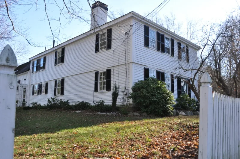
This dwelling at 1196 Central Avenue in Needham, Massachusetts, was built in 1743 by Nathaniel Tolman on a high point of land south of the original town center. It began as a two-story wood frame house with an L-shaped plan, a three-bay west facade and a rear kitchen ell. Later changes include a two-bay extension of the ell, a porch and garage added around 1930, and hip roofs replacing the original gables. The central chimney, fieldstone foundation, eighteenth-century parlor paneling and a large kitchen fireplace with bake ovens remain. The house is associated with John Tolman, a carpenter who was wounded at Menotomy on April 19, 1775, and who later served the town as assessor and sexton. In 1804 it passed to Jonathan Gay, Jr., a schoolmaster and legislator, and Gay descendants owned it until 1923. Nearby streets carry family names from the subdivided farmland.
Significance in brief: The house is tied to Needham's development since the mid-eighteenth century and sits near the original town center. Its main occupants, the Tolman and Gay families, took part in the town's military and governmental affairs. It also keeps much of its original design, interior and exterior fabric.
Machine-generated summary. This summary was generated by a language model from the official nomination document and has not been reviewed line by line by an editor. It may contain errors. Check the source document before relying on any detail. Source: nomination document (PDF) · National Archives catalog entry. NRHP reference 82004419, listed June 1, 1982. Summary generated October 2026 (model claude-sonnet-5-5, prompt v1.0-2026-10-29, confidence high).
Key facts
| Address | 1196 Central Ave., Needham |
|---|---|
| County | Norfolk County |
| Listed | June 1, 1982 |
| Reference number | 82004419 |
| Resource type | Building |
| Period of significance | 1700-1799 |
| Architect / builder | Nathaniel Tolman |
| Criteria |
|
| Areas of significance | Military, Exploration/Settlement, Architecture |
| Level of significance | Local |
| Status (as stated in the nomination) | Occupied as a private residence; described as well maintained by a succession of private owners since 1923. |
| Acreage | 0.8 |
| Coordinates | 42.28017, -71.25038 (NPS GIS) |
What listing means for this property
National Register listing is honorary for a privately owned home: it does not by itself restrict what an owner may do with their own money, and it does not require public access. Restrictions come from local landmark or historic-district ordinances, which are separate (how they differ).
Owner-occupied houses are not eligible for the 20% federal rehabilitation tax credit, which applies to income-producing buildings, but many states offer credits for homeowners. Listing also opens the door to preservation easements and to buying a plaque. Start with what listing means for homeowners, renovating a listed house and selling one.
General information, not legal or tax advice. Rules change; confirm with your State Historic Preservation Office or a qualified adviser.
Sources and further reading
- National Park Service, National Register of Historic Places database (snapshot May 2026), reference 82004419.
- Nomination form (PDF, National Archives) — catalog entry
- Wikipedia article (used for cross-checking only; text not reproduced here)
- Wikidata Q7814438
- This listing as JSON
Last updated October 2026. Found an error? See the editorial policy for how to report it.