Great Blue Hill Observation Tower

Why it's listed
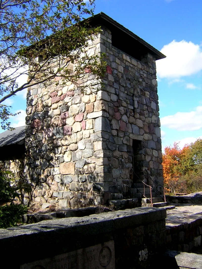
Great Blue Hill Observation Tower crowns the summit of Great Blue Hill in Milton, Massachusetts, the highest point in the Blue Hills range. Built around 1929 of native granite and slate, it measures roughly 20 by 20 feet and rises about 40 feet. It was built by the Metropolitan District Commission for recreation, and it is still used that way, with a picnic shelter attached to the structure. The tower belongs to a larger group of buildings and structures made of local granite in the Blue Hills Reservation. It is described as four-square and sturdy, and its height lets visitors see over the treetops. A comparable tower on Chickatawbut Hill has no attached shelter, which sets this one apart. The property was recorded in 1979 as being in good to fair condition and was included in the multiple-resource nomination for the Blue Hills and Neponset River Reservations.
Significance in brief: The form describes the tower as a vital part of the collection of local-granite structures built in the Blue Hills Reservation. It is four-square and sturdy, and it lets viewers rise above the trees at the highest point in the Blue Hills range. Unlike the Chickatawbut Tower, it has a picnic shelter attached.
Machine-generated summary. This summary was generated by a language model from the official nomination document and has not been reviewed line by line by an editor. It may contain errors. Check the source document before relying on any detail. Source: nomination document (PDF) · National Archives catalog entry. NRHP reference 80000661, listed September 25, 1980. Summary generated October 2026 (model claude-sonnet-5-5, prompt v1.0-2026-10-29, confidence medium).
Key facts
| Address | Milton, Milton |
|---|---|
| County | Norfolk County |
| Listed | September 25, 1980 |
| Reference number | 80000661 |
| Resource type | Building |
| Areas of significance | Entertainment/Recreation |
| Level of significance | State |
| Status (as stated in the nomination) | Condition is listed as good to fair, and the present use is recreation. The tower is owned by the Metropolitan District Commission. |
| Acreage | 0.9 |
| Coordinates | 42.21216, -71.11298 (NPS GIS) |
What listing means for this property
National Register listing is honorary: it recognises significance and does not restrict what a private owner may do without federal money or permits. It unlocks the 20% federal rehabilitation tax credit for income-producing buildings, state credits in many states, and Section 106 review when federal agencies are involved. See what listing means in practice.
General information, not legal or tax advice. Rules change; confirm with your State Historic Preservation Office or a qualified adviser.
Sources and further reading
- National Park Service, National Register of Historic Places database (snapshot May 2026), reference 80000661.
- Nomination form (PDF, National Archives) — catalog entry
- Wikipedia article (used for cross-checking only; text not reproduced here)
- Wikidata Q61989500
- This listing as JSON
Last updated October 2026. Found an error? See the editorial policy for how to report it.