Brookline Town Green Historic District

Why it's listed
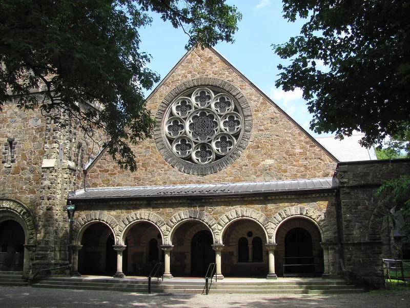
Brookline Town Green Historic District is a quiet residential neighborhood of treed lots, hilly ground and winding streets, built around the triangular green where Walnut and Warren Streets meet. It covers about 61 acres and includes 58 houses, a church, a school and a cemetery established in 1717. The area was the original center of Brookline. The green hosted an early schoolhouse, and local militia gathered there on April 19, 1775. The 1717 First Parish Church, the 1825 Pierce Hall town hall and the cemetery reflect that early role. Town business moved to Brookline Village after new roads and the railroad arrived. In the late 19th and early 20th centuries, old estates were subdivided into large landscaped lots, many designed by Olmsted Associates. Architects such as Peabody and Stearns and Shepley, Rutan and Coolidge produced Shingle, Tudor Revival, Colonial Revival and Richardsonian Romanesque buildings. The district is valued for this cohesive suburban character and its possible archaeological remains.
Significance in brief: The district is the original center of Brookline and a cohesive example of an affluent turn-of-the-century Boston suburb, noted for architectural quality and landscape design, much of it by Olmsted Associates. It is also tied to important people and events in the town's history, and may hold below-grade remains of Colonial settlement.
Machine-generated summary. This summary was generated by a language model from the official nomination document and has not been reviewed line by line by an editor. It may contain errors. Check the source document before relying on any detail. Source: nomination document (PDF) · National Archives catalog entry. NRHP reference 80000650, listed June 22, 1980. Summary generated October 2026 (model claude-sonnet-5-5, prompt v1.0-2026-10-29, confidence medium).
Key facts
| Address | Chestnut Pl., Fairmont, Dudley, Boyston, Walnut and Warren Sts., Hedge, Codman, and Kennard Rds., Brookline |
|---|---|
| County | Norfolk County |
| Listed | June 22, 1980 |
| Reference number | 80000650 |
| Resource type | District |
| Architect / builder | Gridley J.F. Bryant; E. Manton Wakefield; Shepley, Rutan and Coolidge; Peabody and Stearns; John LaValle; Sidney Strickland; Olmsted Associates (landscapes) |
| Architectural style | Greek Revival, Italianate, Queen Anne, Shingle Style, Richardsonian Romanesque, Tudor Revival, Georgian Revival and Colonial Revival |
| Areas of significance | Landscape Architecture, Historic - Non-Aboriginal, Exploration/Settlement, Architecture |
| Level of significance | Local |
| Status (as stated in the nomination) | Condition listed as excellent and altered; the district is occupied and includes private residences, a church, a school, a park and a cemetery. |
| Acreage | 61 |
| Coordinates | 42.32704, -71.12975 (NPS GIS) |
What listing means for this property
This is a historic district. Buildings within its boundary are either contributing (they add to the district's significance) or non-contributing. Owners of contributing income-producing buildings can claim the 20% federal rehabilitation tax credit; homeowners should look at state credits. National Register districts impose no design review by themselves; a local historic district ordinance, if one exists, does (the difference explained).
General information, not legal or tax advice. Rules change; confirm with your State Historic Preservation Office or a qualified adviser.
Sources and further reading
- National Park Service, National Register of Historic Places database (snapshot May 2026), reference 80000650.
- Nomination form (PDF, National Archives) — catalog entry
- Wikipedia article (used for cross-checking only; text not reproduced here)
- Wikidata Q4974700
- This listing as JSON
Last updated October 2026. Found an error? See the editorial policy for how to report it.