Sudbury Aqueduct Linear District

Why it's listed
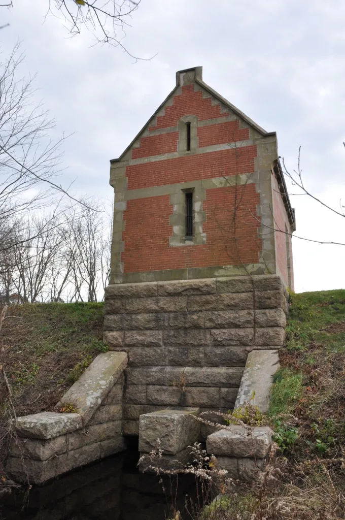
Built between 1875 and 1878, the Sudbury Aqueduct carried water about 16 miles from Farm Pond in Framingham to Chestnut Hill Reservoir in Boston, passing through Natick, Sherborn, Wellesley and Newton. It was built to serve Boston's growing population after the city annexed five neighboring towns in 1874. The horseshoe-shaped conduit is made of brick and stone masonry, with embankments, four tunnels, two bridges (Waban Bridge and the seven-arch Echo Bridge over the Charles River), a siphon, waste weirs, a gatehouse and a metering chamber. George Clough, Boston City Architect, designed several of the structures in a Victorian style. At capacity it delivered 80 million gallons a day. It left service in 1974 but is still used occasionally to move water into the Charles River. The district was listed for its role in Boston's water supply and its late 19th-century engineering and design.
Significance in brief: The nomination argues the aqueduct is important in the history of Boston's water distribution. It was the second in a series of water supply aqueducts and represents late 19th-century water technology, construction methods and municipal architecture. It retains integrity and meets Criteria A and C.
Machine-generated summary. This summary was generated by a language model from the official nomination document and has not been reviewed line by line by an editor. It may contain errors. Check the source document before relying on any detail. Source: nomination document (PDF) · National Archives catalog entry. NRHP reference 89002293, listed January 18, 1990. Summary generated October 2026 (model claude-sonnet-5-5, prompt v1.0-2026-10-29, confidence high).
Key facts
| Address | Along Sudbury Aqueduct from Farm Pond at Waverly St. to Chestnut Hill Reservoir, Framingham |
|---|---|
| County | Middlesex County |
| Listed | January 18, 1990 |
| Reference number | 89002293 |
| Resource type | District |
| Period of significance | 1875-1926 |
| Architect / builder | Engineers J.P. Davis and A. Fteley; contractors Lobdell and Phelps; George A. Clough, Boston City Architect, designed the weirs, gatehouse and terminal chamber; siphon by C. McClallan & Sons; Charles River Bridge by George W. Phelps; Waban Bridge by Boynton Brothers |
| Architectural style | Victorian (municipal waterworks structures); terminal chamber shows Frank Furness influence |
| Criteria |
|
| Areas of significance | Community Planning and Development, Engineering, Politics/Government, Architecture |
| Level of significance | State, Local |
| Status (as stated in the nomination) | Taken out of service in 1974 because of poor water quality, but used occasionally to release water into the Charles River. Condition ranges from the heavily vandalized Farm Pond Gatehouse to the pristine terminal chamber. |
| Acreage | 190 |
| Coordinates | 42.28536, -71.29150 (NPS GIS) |
What listing means for this property
This is a historic district. Buildings within its boundary are either contributing (they add to the district's significance) or non-contributing. Owners of contributing income-producing buildings can claim the 20% federal rehabilitation tax credit; homeowners should look at state credits. National Register districts impose no design review by themselves; a local historic district ordinance, if one exists, does (the difference explained).
General information, not legal or tax advice. Rules change; confirm with your State Historic Preservation Office or a qualified adviser.
Sources and further reading
- National Park Service, National Register of Historic Places database (snapshot May 2026), reference 89002293.
- Nomination form (PDF, National Archives) — catalog entry
- Wikipedia article (used for cross-checking only; text not reproduced here)
- Wikidata Q7633494
- This listing as JSON
Last updated October 2026. Found an error? See the editorial policy for how to report it.