John Eliot Historic District
Also known as: South Natick
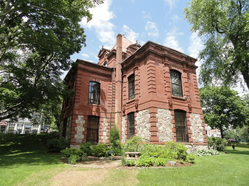

Why it's listed
South Natick is a distinct village within the town of Natick, Massachusetts, and its 71-acre historic district preserves the place where Rev. John Eliot founded a Native American Praying Town in 1651. Eliot Square anchors an X-shaped layout along Eliot, Union and Pleasant Streets, with about fifty buildings, parks, burial grounds, a dam and bridge on the Charles River, and archaeological sites. The architecture ranges from the 1748 Peletiah Morse Tavern to Federal, Greek Revival and Victorian houses, the 1828 Eliot Church and the 1880 Bacon Free Library designed by Colonel Robert G. Shaw. Residents included author Horatio Alger and Harriet Beecher Stowe. The district was listed for its role in early colonial and Native American history, its varied architecture of consistent scale, and its potential to yield information on cultural exchange between Native and European communities in 17th century New England.
Significance in brief: The district is the site of the first Indian Praying Town in the Massachusetts Bay Colony, founded by Rev. John Eliot in 1651, and the area of Natick's first colonial settlement. It is also notable for fine buildings in Georgian, Federal, Greek Revival and Victorian styles, and for residents of national importance such as Horatio Alger and Harriet Beecher Stowe. It offers research potential on contact between Native American and European cultures.
Machine-generated summary. This summary was generated by a language model from the official nomination document and has not been reviewed line by line by an editor. It may contain errors. Check the source document before relying on any detail. Source: nomination document (PDF) · National Archives catalog entry. NRHP reference 83000812, listed June 23, 1983. Summary generated October 2026 (model claude-sonnet-5-5, prompt v1.0-2026-10-29, confidence medium).
Key facts
| Address | Eliot, Pleasant, and Auburn Sts., Natick |
|---|---|
| County | Middlesex County |
| Listed | June 23, 1983 |
| Reference number | 83000812 |
| Resource type | District |
| Architect / builder | Perry, Shaw and Hepburn; Colonel Robert G. Shaw |
| Architectural style | Georgian, Federal, Greek Revival and Early to Late Victorian |
| Criteria |
|
| Areas of significance | Prehistoric, Community Planning and Development, Historic - Aboriginal, Historic - Non-Aboriginal, Literature, Exploration/Settlement, Politics/Government, Religion |
| Level of significance | State |
| Status (as stated in the nomination) | Condition marked excellent and good, altered, original site; the district is occupied and continuously used for residential, religious, commercial, educational, museum and park purposes. |
| Acreage | 71.2 |
| Coordinates | 42.27300, -71.31549 (NPS GIS) |
What listing means for this property
This is a historic district. Buildings within its boundary are either contributing (they add to the district's significance) or non-contributing. Owners of contributing income-producing buildings can claim the 20% federal rehabilitation tax credit; homeowners should look at state credits. National Register districts impose no design review by themselves; a local historic district ordinance, if one exists, does (the difference explained).
General information, not legal or tax advice. Rules change; confirm with your State Historic Preservation Office or a qualified adviser.
Sources and further reading
- National Park Service, National Register of Historic Places database (snapshot May 2026), reference 83000812.
- Nomination form (PDF, National Archives) — catalog entry
- Wikipedia article (used for cross-checking only; text not reproduced here)
- Wikidata Q14715637
- This listing as JSON
Last updated October 2026. Found an error? See the editorial policy for how to report it.