Old Town Bridge
Also known as: Four Arch Bridge

Why it's listed
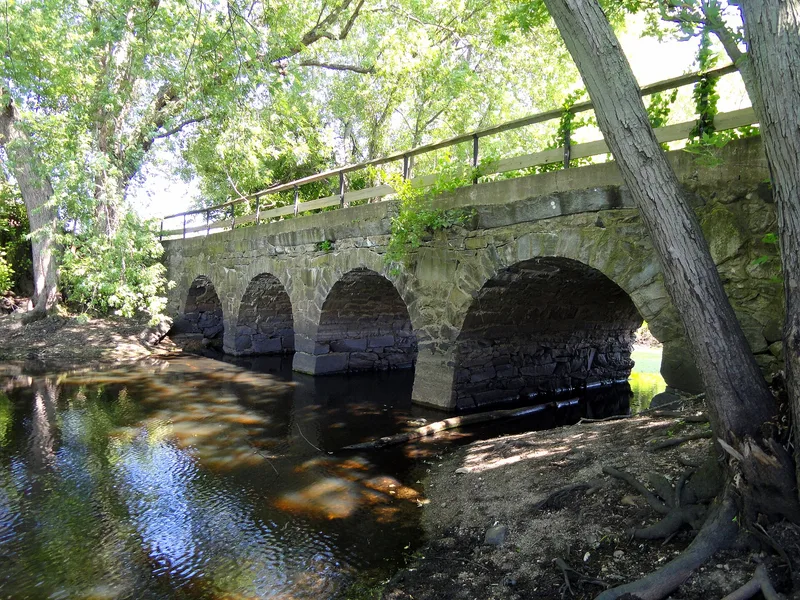
Spanning the Sudbury River in Wayland, Massachusetts, this four-arch bridge of granite slab, rough quarry granite and fieldstone was built in 1848 by Josiah Russell for $500, under a town vote requiring a 30-year warranty. It replaced a line of earlier crossings at the same spot: a foot bridge and ferry in the early 1640s, then a cart bridge contracted in 1643 that is said to be the first frame bridge in Middlesex County. The location was chosen as the narrowest place to cross both river and marsh. In 1676, during King Philip's War, Concord men hurrying to aid Sudbury settlers were ambushed and killed nearby, and a granite marker placed in 1908 commemorates them. Iron ore was later barged from the site toward Chelmsford. Traffic crossed the bridge until 1955, when a widened road bypassed it. Claims that Washington crossed it or that it was the first stone arch bridge in the state cannot be supported, but it remains a significant example of stone arch construction.
Significance in brief: The site is said to have held the first frame bridge in Middlesex County, and the present bridge is an important example of stone arch construction. It stood near the 1676 King Philip's War ambush of Concord men and served as a link between Concord and Sudbury. Iron ore was also shipped by barge from the site after the Middlesex Canal was built.
Machine-generated summary. This summary was generated by a language model from the official nomination document and has not been reviewed line by line by an editor. It may contain errors. Check the source document before relying on any detail. Source: nomination document (PDF) · National Archives catalog entry. NRHP reference 75000292, listed May 2, 1975. Summary generated October 2026 (model claude-sonnet-5-5, prompt v1.0-2026-10-29, confidence medium).
Key facts
| Address | N of Weyland on MA 27, Weyland |
|---|---|
| County | Middlesex County |
| Listed | May 2, 1975 |
| Reference number | 75000292 |
| Resource type | Structure |
| Architect / builder | Josiah Russell (builder; recorded erroneously as William Russell in Hudson's Annals) |
| Areas of significance | Commerce, Military, Engineering, Transportation |
| Level of significance | Local |
| Status (as stated in the nomination) | Generally in good condition, with an asphalt road bed maintained by the Wayland Highway Department; it carried automobile traffic until 1955 and has been bypassed since. |
| Acreage | 0.9 |
| Coordinates | 42.37542, -71.37970 (NPS GIS) |
What listing means for this property
For a publicly owned building or structure, listing mainly matters when federal funds, permits or licences are involved: projects then go through Section 106 review so effects on the property are considered. Listing also strengthens applications for preservation grants and, for leased income-producing uses, can enable the federal rehabilitation tax credit.
General information, not legal or tax advice. Rules change; confirm with your State Historic Preservation Office or a qualified adviser.
Sources and further reading
- National Park Service, National Register of Historic Places database (snapshot May 2026), reference 75000292.
- Nomination form (PDF, National Archives) — catalog entry
- Wikipedia article (used for cross-checking only; text not reproduced here)
- Wikidata Q7085269
- This listing as JSON
Last updated October 2026. Found an error? See the editorial policy for how to report it.