Milestone
Also known as: #903

Why it's listed
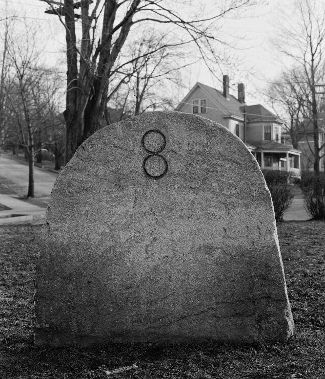
A small carved stone marks the junction of Appleton Street and Paul Revere Road in Arlington, Massachusetts. Dating to about 1790, the milestone measures roughly 40 by 42 inches and is 8 inches thick. A carved "8" at its center shows the distance to Boston. It is the only milestone still standing in Arlington, where several once marked mileage along the main routes through town. In the 18th and early 19th centuries Appleton Street was part of a major route west from Boston. A short extension of what is now Massachusetts Avenue in 1811 bypassed both the street and its stone. Roadway changes in 1940 required moving the marker slightly to its present spot on a triangle of grass, and the Arlington Historical Society helped see it preserved. The stone is listed for its association with a major transportation route and for retaining its original design, material and workmanship. It remains in excellent condition under town ownership.
Significance in brief: It is the only milestone still standing in Arlington and one of several that marked mileage along the town's major routes. It retains integrity of design, material, feeling, workmanship and association with a major transportation route, meeting Criterion A.
Machine-generated summary. This summary was generated by a language model from the official nomination document and has not been reviewed line by line by an editor. It may contain errors. Check the source document before relying on any detail. Source: nomination document (PDF) · National Archives catalog entry. NRHP reference 85002683, listed September 27, 1985. Summary generated October 2026 (model claude-sonnet-5-5, prompt v1.0-2026-10-29, confidence medium).
Key facts
| Address | Appleton St. and Paul Revere Rd., Arlington |
|---|---|
| County | Middlesex County |
| Listed | September 27, 1985 |
| Reference number | 85002683 |
| Resource type | Object |
| Criteria |
|
| Areas of significance | Transportation |
| Level of significance | Local |
| Status (as stated in the nomination) | Condition is stated as excellent; it was moved slightly to its present position in 1940 during roadway changes. |
| Acreage | 0.9 |
| Coordinates | 42.42251, -71.18141 (NPS GIS) |
What listing means for this property
National Register listing is honorary: it recognises significance and does not restrict what a private owner may do without federal money or permits. It unlocks the 20% federal rehabilitation tax credit for income-producing buildings, state credits in many states, and Section 106 review when federal agencies are involved. See what listing means in practice.
General information, not legal or tax advice. Rules change; confirm with your State Historic Preservation Office or a qualified adviser.
Sources and further reading
- National Park Service, National Register of Historic Places database (snapshot May 2026), reference 85002683.
- Nomination form (PDF, National Archives) — catalog entry
- Wikipedia article (used for cross-checking only; text not reproduced here)
- Wikidata Q6851602
- This listing as JSON
Last updated October 2026. Found an error? See the editorial policy for how to report it.