Boston Post Road Historic District

Why it's listed
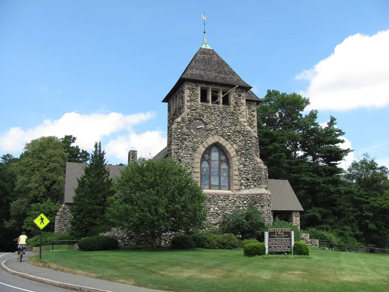
Running 3.5 miles east to west through Weston, Massachusetts, this district follows the Boston Post Road, a main east-west route that began as a Native American trail. About 170 major buildings, along with barns and outbuildings, span roughly 250 years, from Georgian houses and taverns to Colonial Revival public buildings. Weston's economy thrived on travelers in the 18th and early 19th centuries, and the Golden Ball Tavern of 1768 and the Josiah Smith Tavern of 1757 survive from that era, along with two Federal-period law offices. Later growth came with railroads and suburban estates, and around 1900 the town built its church, library, town hall and fire station, all designed by Boston architects. The Town Green, laid out in 1917, anchors the center. Parks and conservation land have helped the district keep its rural character. The district is also considered likely to hold archaeological remains.
Significance in brief: The district is the historic center of Weston, which thrived on travelers' trade in the 18th and early 19th centuries, and holds the state's best preserved segment of this major east-west route. It contains important Georgian and Federal buildings, including taverns and law offices, plus a large group of turn-of-the-century civic buildings from suburbanization. The form states it meets criteria A and C.
Machine-generated summary. This summary was generated by a language model from the official nomination document and has not been reviewed line by line by an editor. It may contain errors. Check the source document before relying on any detail. Source: nomination document (PDF) · National Archives catalog entry. NRHP reference 83000783, listed February 11, 1983. Summary generated October 2026 (model claude-sonnet-5-5, prompt v1.0-2026-10-29, confidence high).
Key facts
| Address | Both sides of the Boston Post Rd. from Plain Rd. to Stony Brook, Weston |
|---|---|
| County | Middlesex County |
| Listed | February 11, 1983 |
| Reference number | 83000783 |
| Resource type | District |
| Period of significance | 1700-1799, 1800-1899, 1900- |
| Architect / builder | Jeduthan Baldwin and John Paradee (housewrights); Samuel Mead; Peabody and Stearns; Joseph Chandler; Fox, Jenney and Gale; Bigelow and Wadsworth; Clifford Albright; Arthur Shurcliffe (landscape architect) |
| Architectural style | Georgian, Federal, Greek Revival, Italianate, Queen Anne, Stick, Colonial Revival and other revival styles |
| Criteria |
|
| Areas of significance | Industry, Commerce, Politics/Government, Architecture, Religion |
| Level of significance | Local |
| Status (as stated in the nomination) | Buildings and grounds are generally well preserved and well maintained; uses include residences, a museum, schools, town offices, churches and commercial buildings. |
| Acreage | 760 |
| Coordinates | 42.36692, -71.30500 (NPS GIS) |
What listing means for this property
This is a historic district. Buildings within its boundary are either contributing (they add to the district's significance) or non-contributing. Owners of contributing income-producing buildings can claim the 20% federal rehabilitation tax credit; homeowners should look at state credits. National Register districts impose no design review by themselves; a local historic district ordinance, if one exists, does (the difference explained).
General information, not legal or tax advice. Rules change; confirm with your State Historic Preservation Office or a qualified adviser.
Sources and further reading
- National Park Service, National Register of Historic Places database (snapshot May 2026), reference 83000783.
- Nomination form (PDF, National Archives) — catalog entry
- Wikipedia article (used for cross-checking only; text not reproduced here)
- Wikidata Q4948033
- This listing as JSON
Last updated October 2026. Found an error? See the editorial policy for how to report it.