Westside Historic District

Why it's listed
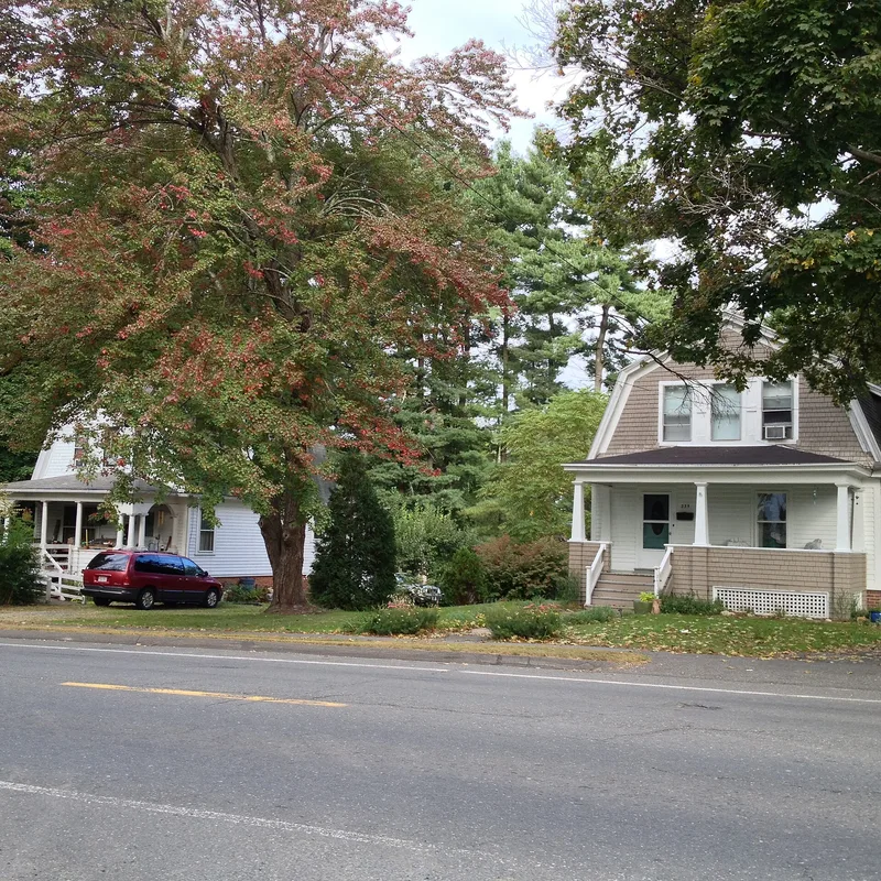
Westside is a 40-acre neighborhood about half a mile west of downtown Amherst, made up of modest houses and open farm fields along Baker Street, Snell Street, Hazel Avenue and Northampton Road. It contains 44 contributing buildings and one contributing site, mostly Victorian Eclectic residences from the late 19th century. The oldest, the Hawkins House on Baker Street, dates to about 1869. Nearly half the buildings share a front-gabled, two-story, two- or three-bay form with porches and plain eaves. Other styles include Italianate, Dutch Colonial Revival, English Revival, Craftsman and Cape Cod. The houses were built for farm workers, laborers and small businessmen, and cornfields still occupy the district's core. The district was recognized for its long association with the African American community, which lived there for over a century, and for architecture that reflects 19th-century design, construction and planning. Some residents objected to the boundaries and to how their family histories were treated.
Significance in brief: The nomination points to the district's occupation by African Americans for over a century and to its 19th-century architecture. A recurring front-gabled Victorian Eclectic house form gives the area cohesion, and surviving farm fields add to its historic appearance.
Machine-generated summary. This summary was generated by a language model from the official nomination document and has not been reviewed line by line by an editor. It may contain errors. Check the source document before relying on any detail. Source: nomination document (PDF) · National Archives catalog entry. NRHP reference 00000793, listed July 25, 2000. Summary generated October 2026 (model claude-sonnet-5-5, prompt v1.0-2026-10-29, confidence medium).
Key facts
| Address | Baker and Snell Sts., Northampton Rd., and Hazel Ave., Amherst |
|---|---|
| County | Hampshire County |
| Listed | July 25, 2000 |
| Reference number | 00000793 |
| Resource type | District |
| Architectural style | Victorian Eclectic, Colonial Revival, Craftsman/Bungalow, Italianate |
| Areas of significance | Agriculture, Architecture, Community Planning and Development, Black, European |
| Level of significance | Local |
| Status (as stated in the nomination) | Residential and agricultural use continues; farm fields are still cultivated in corn, and most houses are described as well maintained. |
| Acreage | 40 |
| Coordinates | 42.36696, -72.53027 (NPS GIS) |
What listing means for this property
This is a historic district. Buildings within its boundary are either contributing (they add to the district's significance) or non-contributing. Owners of contributing income-producing buildings can claim the 20% federal rehabilitation tax credit; homeowners should look at state credits. National Register districts impose no design review by themselves; a local historic district ordinance, if one exists, does (the difference explained).
General information, not legal or tax advice. Rules change; confirm with your State Historic Preservation Office or a qualified adviser.
Sources and further reading
- National Park Service, National Register of Historic Places database (snapshot May 2026), reference 00000793.
- Nomination form (PDF, National Archives) — catalog entry
- Wikipedia article (used for cross-checking only; text not reproduced here)
- Wikidata Q7989699
- This listing as JSON
Last updated October 2026. Found an error? See the editorial policy for how to report it.