Amherst West Cemetery

Why it's listed
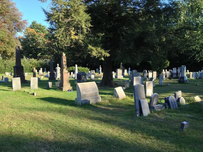
West Cemetery in Amherst, Massachusetts, is a four-acre burial ground on Triangle Street, established in 1730 when Hadley voters approved a new burying place for their east precinct. The town of Amherst took over its care in 1786. The earliest surviving stone dates to 1737. Hundreds of Colonial slate markers carry death's heads and portal designs, while Victorian limestone, marble and granite monuments include obelisks, chest markers and a single zinc monument. Poet Emily Dickinson is buried near the center with her family. Many early settlers, politicians and businessmen also rest here, including the Boltwood, Seelye, Cowles, Cutler and Kellogg families. The southeast corner holds about fifty graves of Black residents, among them Civil War soldiers. Between 1833 and 1854 the town added fencing, a town tomb and curving paths, following the rural cemetery movement. Granite gateways from 1907 and 1954 mark the entrances, and a small shed from about 1920 is the only building.
Significance in brief: The cemetery holds hundreds of Colonial-era slate markers, Victorian monuments and the grave of poet Emily Dickinson. Its stones show changing carving styles and mark the town's leading families, and it contains a section of African American burials including Civil War veterans. Its 1833-1854 upgrades reflect the rural cemetery movement.
Machine-generated summary. This summary was generated by a language model from the official nomination document and has not been reviewed line by line by an editor. It may contain errors. Check the source document before relying on any detail. Source: nomination document (PDF) · National Archives catalog entry. NRHP reference 00000534, listed May 26, 2000. Summary generated October 2026 (model claude-sonnet-5-5, prompt v1.0-2026-10-29, confidence medium).
Key facts
| Address | Triangle St., Amherst |
|---|---|
| County | Hampshire County |
| Listed | May 26, 2000 |
| Reference number | 00000534 |
| Resource type | Site |
| Areas of significance | Art, Community Planning and Development, Black |
| Level of significance | Local |
| Status (as stated in the nomination) | Still in use as a cemetery; the figure-eight path remains in use today. |
| Acreage | 4 |
| Coordinates | 42.37939, -72.51801 (NPS GIS) |
What listing means for this property
Sites (archaeological sites, battlefields, landscapes) are often listed with a restricted address to protect them from looting or disturbance. Listing is honorary for private owners; federal undertakings on or near the site go through Section 106 review, and state laws may protect burials and artefacts regardless of listing.
General information, not legal or tax advice. Rules change; confirm with your State Historic Preservation Office or a qualified adviser.
Sources and further reading
- National Park Service, National Register of Historic Places database (snapshot May 2026), reference 00000534.
- Nomination form (PDF, National Archives) — catalog entry
- Wikipedia article (used for cross-checking only; text not reproduced here)
- Wikidata Q4746056
- This listing as JSON
Last updated October 2026. Found an error? See the editorial policy for how to report it.