Prospect Park
Also known as: Pulaski Park; Kerry Park

Why it's listed
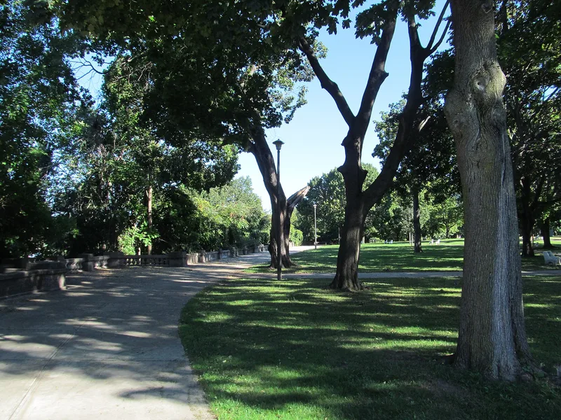
Prospect Park is a five-acre public park on a bluff above the Connecticut River in Holyoke, Massachusetts. A concrete parapet wall about 1,451 feet long, with four balustraded lookouts and a wide promenade, runs along the river edge, and symmetrical paths lead to a central memorial garden honoring Casimir Pulaski. The land was once a shanty settlement called the Patch, home to Irish laborers who built the Holyoke dam and canals, and it became a park in 1884. The wall and path layout were built between 1905 and 1910 under City Engineer John Tighe in consultation with the Olmsted Brothers. The park was listed for its role as an intact example of an urban park serving a crowded mill city, offering river views and passive recreation to workers. Urban renewal in the 1960s changed the surrounding neighborhood, and the park today needs repairs and vegetation clearing to restore its views.
Significance in brief: The nomination argues the park is an intact example of an urban park developed between 1884 and 1910 for a fast-growing industrial city. It is tied to the Irish immigrant mill workers who built Holyoke and to the Olmsted Brothers' preliminary planning, and it reflects the Municipal Park Movement's aim of giving mill workers greenery and river views close to home.
Machine-generated summary. This summary was generated by a language model from the official nomination document and has not been reviewed line by line by an editor. It may contain errors. Check the source document before relying on any detail. Source: nomination document (PDF) · National Archives catalog entry. NRHP reference 04000931, listed September 10, 2004. Summary generated October 2026 (model claude-sonnet-5-5, prompt v1.0-2026-10-29, confidence high).
Key facts
| Address | Maple St., Arbor Way, Connecticut R, Holyoke |
|---|---|
| County | Hampden County |
| Listed | September 10, 2004 |
| Reference number | 04000931 |
| Resource type | Site |
| Period of significance | 1884-1954 |
| Architect / builder | John Tighe, Holyoke City Engineer 1892-1911 in consultation with Olmsted Brothers |
| Criteria |
|
| Areas of significance | Community Planning and Development, Landscape Architecture, Entertainment/Recreation |
| Level of significance | Local |
| Status (as stated in the nomination) | In fair condition, with deferred maintenance, a deteriorating parapet wall, one lookout closed as unsafe, and views blocked by overgrown vegetation. It is still used as a park. |
| Acreage | 5.2 |
| Coordinates | 42.21152, -72.60462 (NPS GIS) |
What listing means for this property
Sites (archaeological sites, battlefields, landscapes) are often listed with a restricted address to protect them from looting or disturbance. Listing is honorary for private owners; federal undertakings on or near the site go through Section 106 review, and state laws may protect burials and artefacts regardless of listing.
General information, not legal or tax advice. Rules change; confirm with your State Historic Preservation Office or a qualified adviser.
Sources and further reading
- National Park Service, National Register of Historic Places database (snapshot May 2026), reference 04000931.
- Nomination form (PDF, National Archives) — catalog entry
- Wikipedia article (used for cross-checking only; text not reproduced here)
- Wikidata Q7250794
- This listing as JSON
Last updated October 2026. Found an error? See the editorial policy for how to report it.