Old Deerfield Village Historic District
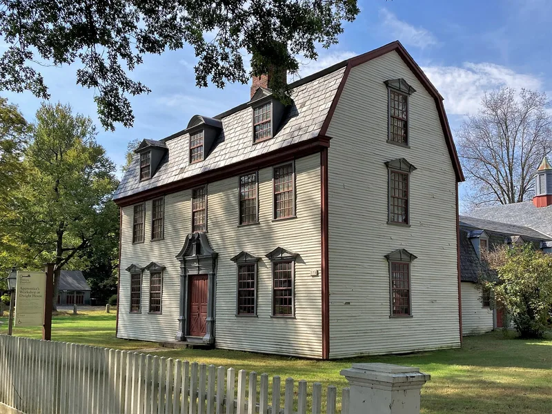

Why it's listed
Old Deerfield Village Historic District in Franklin County, Massachusetts, includes a large group of houses from the 1700s and early 1800s. This supplemental material records new construction dates for roughly twenty of them, based on tree-ring analysis done mainly by conservator William Flynt of Historic Deerfield in 2001 and 2004. Timbers from attics and roof frames were sampled and matched against dated ring sequences. The Eliezer Hawks House was dated to 1714, the Timothy Childs House to 1730, the Allen House to 1734, and the Eldad Bardwell House to 1771-72. Some results matched written records, such as house fires followed by rebuilding. Others showed reused timber or later work, as at the Nims House, where roof framing dates to the early 1790s, and the Hinsdell-Williams House, remodeled in 1817. A few buildings, including the William Russell House, still lack firm dates. The district was listed in 1966 and is also a National Historic Landmark.
Significance in brief: The supplement does not restate the district's original significance. It reports that tree-ring testing of attic and roof timbers in about 20 village houses refined or changed their dates, with results ranging from the early 1710s to the 1820s. The findings sometimes match deeds, account books and fire records, and sometimes show reused timber or later remodeling.
Machine-generated summary. This summary was generated by a language model from the official nomination document and has not been reviewed line by line by an editor. It may contain errors. Check the source document before relying on any detail. Source: nomination document (PDF) · National Archives catalog entry. NRHP reference 66000774, listed October 15, 1966. Summary generated October 2026 (model claude-sonnet-5-5, prompt v1.0-2026-10-29, confidence low).
Key facts
| Address | W of US 5, bounded by Mill Village Rd., "The Street", Broughton's Pond Rd., and Pogues Hole Rd., Deerfield |
|---|---|
| County | Franklin County |
| Listed | October 15, 1966 |
| Reference number | 66000774 |
| Resource type | District |
| Areas of significance | Exploration/Settlement |
| Level of significance | National |
| National Historic Landmark | Yes, designated October 9, 1960 |
| Acreage | 800 |
| Coordinates | 42.54347, -72.60449 (NPS GIS) |
What listing means for this property
This is a historic district. Buildings within its boundary are either contributing (they add to the district's significance) or non-contributing. Owners of contributing income-producing buildings can claim the 20% federal rehabilitation tax credit; homeowners should look at state credits. National Register districts impose no design review by themselves; a local historic district ordinance, if one exists, does (the difference explained).
General information, not legal or tax advice. Rules change; confirm with your State Historic Preservation Office or a qualified adviser.
Sources and further reading
- National Park Service, National Register of Historic Places database (snapshot May 2026), reference 66000774.
- Nomination form (PDF, National Archives) — catalog entry
- Wikipedia article (used for cross-checking only; text not reproduced here)
- Wikidata Q49534964
- This listing as JSON
Last updated October 2026. Found an error? See the editorial policy for how to report it.