Pleasant-High Historic District

Why it's listed
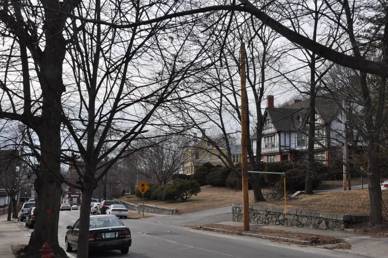
This residential neighborhood next to downtown Methuen, Massachusetts, grew between about 1810 and 1910 on a ridge above the Spicket River. Development began after the 1806 Essex Turnpike was built, when the town was still a small settlement. Later the expanding Methuen Cotton Mills brought mill workers, merchants, managers and professionals to the area, and the Nevins Park subdivision of the 1890s offered homesites to Lawrence mill managers. The district holds about 25 surveyed buildings in late Federal, Greek Revival, Second Empire, Italianate, Queen Anne, Shingle and Georgian Revival styles. Notable landmarks include the granite Gothic Revival First Church Congregational of 1855 and an 1888 Civil War monument with lions and an eagle, which preserves open space at the southern edge. Retaining walls, granite fenceposts and 19th-century wooden fences survive. It is considered the town's largest and most intact group of 19th-century houses and a record of its settlement patterns.
Significance in brief: It is described as the town's largest and most intact collection of 19th-century residential buildings, with good examples of nearly all the major styles. It also shows how Methuen's commercial, civic, industrial and residential activities consolidated in one central location. The form states it meets criteria A and C.
Machine-generated summary. This summary was generated by a language model from the official nomination document and has not been reviewed line by line by an editor. It may contain errors. Check the source document before relying on any detail. Source: nomination document (PDF) · National Archives catalog entry. NRHP reference 84002417, listed June 20, 1984. Summary generated October 2026 (model claude-sonnet-5-5, prompt v1.0-2026-10-29, confidence medium).
Key facts
| Address | Roughly bounded by Broadway, High, Vine, Charles, and Pleasant Sts., Methuen |
|---|---|
| County | Essex County |
| Listed | June 20, 1984 |
| Reference number | 84002417 |
| Resource type | District |
| Period of significance | 1810-1910 |
| Architectural style | Late Federal, Greek Revival, Second Empire, Italianate, Queen Anne, Gothic Revival, Shingle, Georgian Revival and Period Revival |
| Criteria |
|
| Areas of significance | Community Planning and Development, Landscape Architecture, Architecture |
| Level of significance | Local |
| Acreage | 14.4 |
| Coordinates | 42.72954, -71.18629 (NPS GIS) |
What listing means for this property
This is a historic district. Buildings within its boundary are either contributing (they add to the district's significance) or non-contributing. Owners of contributing income-producing buildings can claim the 20% federal rehabilitation tax credit; homeowners should look at state credits. National Register districts impose no design review by themselves; a local historic district ordinance, if one exists, does (the difference explained).
General information, not legal or tax advice. Rules change; confirm with your State Historic Preservation Office or a qualified adviser.
Sources and further reading
- National Park Service, National Register of Historic Places database (snapshot May 2026), reference 84002417.
- Nomination form (PDF, National Archives) — catalog entry
- Wikipedia article (used for cross-checking only; text not reproduced here)
- Wikidata Q7203762
- This listing as JSON
Last updated October 2026. Found an error? See the editorial policy for how to report it.