Fish Flake Hill Historic District
Also known as: Front Street Historic District; See Also:Fish Flake Hill Hist

Why it's listed
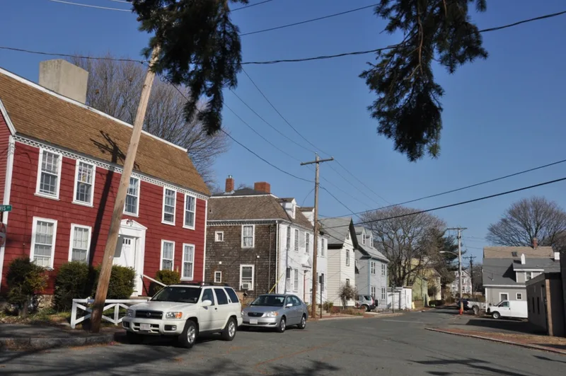
Fish Flake Hill rises steeply from Beverly Harbor, and Front Street runs along its slope between Bartlett and Cabot Streets. Twenty-four wooden buildings stand close together within ten feet of the street, ranging from one and a half to three stories. Twelve date to the 18th century and show Colonial and Federal character, while one is dated to 1641 though altered, and the rest are mid to late 19th-century vernacular. The hill takes its name from the fish-drying flakes once found here. Development accelerated after 1764, when sea captains bought wharves and built homes overlooking the harbor. Blacksmiths, coopers, chandleries, and ship outfitters made it Beverly's business center. During the Revolution, the Hannah was outfitted at General John Glover's wharf and sailed in September 1775 as the first ship of Washington's New England Fleet, and privateers brought some six hundred captured ships to Beverly's wharves. Many buildings are altered and the area was in deteriorated condition at listing.
Significance in brief: The district was Beverly's 18th-century fishing center and business section, with wharves, chandleries, and shops serving ships. It was the center of the town's Revolutionary War activity, including outfitting the Hannah for Washington's fleet and distributing captured prizes. It still holds homes of fishermen, sea captains, and privateers.
Machine-generated summary. This summary was generated by a language model from the official nomination document and has not been reviewed line by line by an editor. It may contain errors. Check the source document before relying on any detail. Source: nomination document (PDF) · National Archives catalog entry. NRHP reference 71000082, listed October 26, 1971. Summary generated October 2026 (model claude-sonnet-5-5, prompt v1.0-2026-10-29, confidence medium).
Key facts
| Address | N and S sides of Front St. from Cabot to Bartlett Sts., Beverly |
|---|---|
| County | Essex County |
| Listed | October 26, 1971 |
| Reference number | 71000082 |
| Resource type | District |
| Period of significance | 18th Century |
| Architectural style | Colonial and Federal, with later American vernacular buildings |
| Areas of significance | Commerce, Military, Architecture, Maritime History |
| Level of significance | Local |
| Status (as stated in the nomination) | Described as deteriorated; most buildings converted to tenement or commercial use, five restored or being restored, and three vacant buildings that a preservation foundation was trying to save. |
| Acreage | 0.5 |
| Coordinates | 42.54174, -70.88293 (NPS GIS) |
What listing means for this property
This is a historic district. Buildings within its boundary are either contributing (they add to the district's significance) or non-contributing. Owners of contributing income-producing buildings can claim the 20% federal rehabilitation tax credit; homeowners should look at state credits. National Register districts impose no design review by themselves; a local historic district ordinance, if one exists, does (the difference explained).
General information, not legal or tax advice. Rules change; confirm with your State Historic Preservation Office or a qualified adviser.
Sources and further reading
- National Park Service, National Register of Historic Places database (snapshot May 2026), reference 71000082.
- Nomination form (PDF, National Archives) — catalog entry
- Wikipedia article (used for cross-checking only; text not reproduced here)
- Wikidata Q5454516
- This listing as JSON
Last updated October 2026. Found an error? See the editorial policy for how to report it.