First Parish Burial Ground
Also known as: Bridge Street Cemetery; Old Bridge Street Cemetery; First; Parish Burial Yard; Bridge Street Burial Yard

Why it's listed
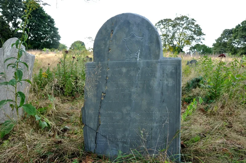
Established in 1644 near Gloucester Harbor and the Annisquam River, this 2.5-acre burial ground is the oldest cemetery in Gloucester. It served as the only burial place for the original settlement for nearly 80 years. Roughly hexagonal, it is bounded largely by dry-laid stone walls and entered through a granite wall and wrought-iron gate on Centennial Avenue. About 650 markers are reported. Early slate, schist and sandstone tablets carry winged skulls, cherubs, and willow-and-urn designs, some tied to carvers such as John Homer and the Lamson shop, while later marble stones show Victorian imagery. The grounds also include family plots and tombs, among them those of Rev. John White and Captain Edward Gibaut. Burials slowed after 1830, and the last took place in 1925. Decades of neglect, vegetation growth and vandalism have damaged the site, yet it keeps its location, setting and association with Gloucester's founding families, and it also holds potential for archaeological discovery.
Significance in brief: It is Gloucester's oldest cemetery and was the only burial place for the original settlement for nearly 80 years. It is significant for its association with the early settlement and maritime history of Gloucester (Criterion A). Its gravestones also show the work of local carvers and changing memorial art from the 1700s through the 1800s (Criterion C).
Machine-generated summary. This summary was generated by a language model from the official nomination document and has not been reviewed line by line by an editor. It may contain errors. Check the source document before relying on any detail. Source: nomination document (PDF) · National Archives catalog entry. NRHP reference 10000040, listed February 26, 2010. Summary generated October 2026 (model claude-sonnet-5-5, prompt v1.0-2026-10-29, confidence high).
Key facts
| Address | 122-R Centennial Ave., Gloucester |
|---|---|
| County | Essex County |
| Listed | February 26, 2010 |
| Reference number | 10000040 |
| Resource type | Site |
| Period of significance | 1644-1925 |
| Criteria |
|
| Areas of significance | Art, Exploration/Settlement, Landscape Architecture, Maritime History, Social History |
| Level of significance | Local |
| Status (as stated in the nomination) | Seriously deteriorated: overgrown with vegetation, vandalized, with broken, fallen and displaced stones and a poorly kept perimeter wall. |
| Acreage | 2.5 |
| Coordinates | 42.61737, -70.67429 (NPS GIS) |
What listing means for this property
Sites (archaeological sites, battlefields, landscapes) are often listed with a restricted address to protect them from looting or disturbance. Listing is honorary for private owners; federal undertakings on or near the site go through Section 106 review, and state laws may protect burials and artefacts regardless of listing.
General information, not legal or tax advice. Rules change; confirm with your State Historic Preservation Office or a qualified adviser.
Sources and further reading
- National Park Service, National Register of Historic Places database (snapshot May 2026), reference 10000040.
- Nomination form (PDF, National Archives) — catalog entry
- Wikipedia article (used for cross-checking only; text not reproduced here)
- Wikidata Q16836964
- This listing as JSON
Last updated October 2026. Found an error? See the editorial policy for how to report it.