Neck of Land Cemetery

Why it's listed
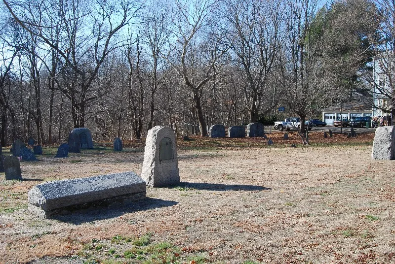
Neck of Land Cemetery is a half-acre burying ground on Summer Street in Taunton, Massachusetts, at the point where the Taunton and Mill Rivers meet. It is regarded as the oldest burying ground in the city. No record survives of how it was laid out or where its boundaries ran, and it may once have extended across what is now Summer Street, which could explain why the graves of the earliest settlers have not been found. About 123 gravestones remain, with death dates from 1687 to 1889. The oldest stones mark Elizabeth Smith and Damaris Smith. Others commemorate John Deane, the first child born in Taunton, and Seth Williams, a judge of the Court of Common Pleas. The city-owned site was listed for its age and distinctive design features, and it was judged to retain integrity of location, design, setting, materials, workmanship and association.
Significance in brief: The nomination argues the cemetery is significant for its age and distinctive design features, and says it meets Criterion C. It is described as the oldest burying ground in the city, with gravestones dating from 1687 to 1889.
Machine-generated summary. This summary was generated by a language model from the official nomination document and has not been reviewed line by line by an editor. It may contain errors. Check the source document before relying on any detail. Source: nomination document (PDF) · National Archives catalog entry. NRHP reference 85001530, listed July 10, 1985. Summary generated October 2026 (model claude-sonnet-5-5, prompt v1.0-2026-10-29, confidence medium).
Key facts
| Address | Summer St., Taunton |
|---|---|
| County | Bristol County |
| Listed | July 10, 1985 |
| Reference number | 85001530 |
| Resource type | Site |
| Criteria |
|
| Areas of significance | Landscape Architecture |
| Level of significance | Local |
| Status (as stated in the nomination) | Recorded in the 1978 survey as well kept up, with about 123 gravestones. |
| Acreage | 0.5 |
| Coordinates | 41.89790, -71.08546 (NPS GIS) |
What listing means for this property
Sites (archaeological sites, battlefields, landscapes) are often listed with a restricted address to protect them from looting or disturbance. Listing is honorary for private owners; federal undertakings on or near the site go through Section 106 review, and state laws may protect burials and artefacts regardless of listing.
General information, not legal or tax advice. Rules change; confirm with your State Historic Preservation Office or a qualified adviser.
Sources and further reading
- National Park Service, National Register of Historic Places database (snapshot May 2026), reference 85001530.
- Nomination form (PDF, National Archives) — catalog entry
- Wikipedia article (used for cross-checking only; text not reproduced here)
- Wikidata Q14715753
- This listing as JSON
Last updated October 2026. Found an error? See the editorial policy for how to report it.