Assonet Historic District

Why it's listed
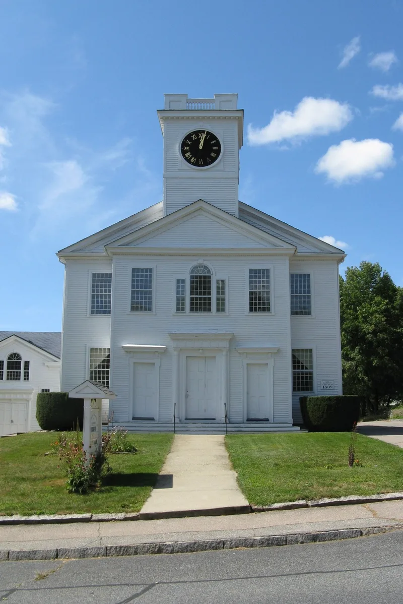
Assonet Historic District is a compact village center in Freetown, Massachusetts, at the point where the Assonet River flows into Assonet Bay. The community grew from the late 1600s along crossroads formed by North and South Main Streets and Water and Elm Streets. Today it holds 196 contributing resources, mostly frame houses clad in clapboard or shingle, with granite walls, foundations and fence posts visible throughout. Houses range from a gambrel-roofed dwelling of about 1720 to mid-20th-century homes, with a noticeable concentration of Georgian and Federal buildings. Other features include a Federal-style Congregational Church of 1809, a Town Hall of 1888, a former village school, a cattle pound built into a bluff, mill and dam remains, and two fieldstone bridges. The village's history includes shipping, boat building, mills and a gun-making firm established in the 1850s. Although many commercial and industrial buildings are gone, the layout along historic routes and the river survives largely intact.
Significance in brief: The district keeps a well-preserved village fabric with a strong Georgian and Federal character, plus industrial remains, 19th-century boat-building sites, stone bridges, a cattle pound and several burial grounds. It records the settlement from the late 17th century through shipping, commerce and early industry, including gun manufacturing.
Machine-generated summary. This summary was generated by a language model from the official nomination document and has not been reviewed line by line by an editor. It may contain errors. Check the source document before relying on any detail. Source: nomination document (PDF) · National Archives catalog entry. NRHP reference 99001116, listed September 9, 1999. Summary generated October 2026 (model claude-sonnet-5-5, prompt v1.0-2026-10-29, confidence medium).
Key facts
| Address | Roughly bounded by MA 24, a private Ln., Conrail RR Tracks, and High St., Freetown |
|---|---|
| County | Bristol County |
| Listed | September 9, 1999 |
| Reference number | 99001116 |
| Resource type | District |
| Architect / builder | Charles C. Marble (Town Hall, 1888); Ebenezer Pierce (Congregational Church, 1809) |
| Architectural style | Colonial - Georgian; Early Republic - Federal; Mid-19th Century - Gothic Revival |
| Areas of significance | Architecture, Commerce, Community Planning and Development, Politics/Government, Industry |
| Level of significance | Local |
| Status (as stated in the nomination) | Most commercial and water-powered industrial buildings have been demolished, leaving gaps in the village fabric. Many buildings have been altered but most keep basic design integrity. |
| Acreage | 190 |
| Coordinates | 41.79362, -71.07183 (NPS GIS) |
What listing means for this property
This is a historic district. Buildings within its boundary are either contributing (they add to the district's significance) or non-contributing. Owners of contributing income-producing buildings can claim the 20% federal rehabilitation tax credit; homeowners should look at state credits. National Register districts impose no design review by themselves; a local historic district ordinance, if one exists, does (the difference explained).
General information, not legal or tax advice. Rules change; confirm with your State Historic Preservation Office or a qualified adviser.
Sources and further reading
- National Park Service, National Register of Historic Places database (snapshot May 2026), reference 99001116.
- Nomination form (PDF, National Archives) — catalog entry
- Wikidata Q115733622
- This listing as JSON
Last updated October 2026. Found an error? See the editorial policy for how to report it.