Tyringham Cemetery

Why it's listed
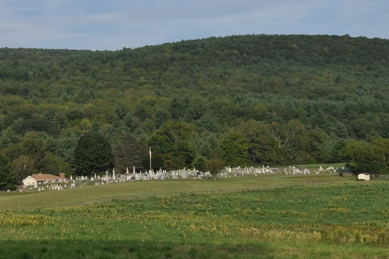
Tyringham Cemetery occupies 3.67 acres on Church Road at the edge of the village center, overlooking the Hop Brook valley. Roughly 800 stone markers record more than 1,300 residents, with burials from 1797 to the present. A horseshoe-shaped driveway divides the grounds, and a late 19th-century iron fence with cast-iron bow and dart details runs along three boundaries. The oldest section holds marble tablets whose carving moves from angel heads and pinwheels to urn-and-willow motifs, plain rectilinear lettering, arched tops and carved lambs for children. Larger urn and obelisk monuments mark prominent families such as the Garfields, Joneses and Hales. Fourteen white bronze monuments, no two alike, are unusual for a rural cemetery. The first meetinghouse, built in 1779 and removed after 1844, stood somewhere within the grounds, though its exact location is undocumented. The cemetery is valued as a record of local gravestone craft and community history.
Significance in brief: The nomination presents the cemetery as a well-preserved record of rural New England gravestone design from the late 18th century through the 20th century, including Neoclassical marble tablets, urns and obelisks. It also holds an unusually large group of fourteen white bronze (zinc) monuments and marks the site of the town's first meetinghouse. It further documents the families, farmers and manufacturers who shaped the Hop Brook valley.
Machine-generated summary. This summary was generated by a language model from the official nomination document and has not been reviewed line by line by an editor. It may contain errors. Check the source document before relying on any detail. Source: nomination document (PDF) · National Archives catalog entry. NRHP reference 09000716, listed September 16, 2009. Summary generated October 2026 (model claude-sonnet-5-5, prompt v1.0-2026-10-29, confidence medium).
Key facts
| Address | Church Rd., Tyringham |
|---|---|
| County | Berkshire County |
| Listed | September 16, 2009 |
| Reference number | 09000716 |
| Resource type | Site |
| Areas of significance | Art, Community Planning and Development |
| Level of significance | Local |
| Status (as stated in the nomination) | Still used as a cemetery; a south section added in 1956 holds more recent burials, and an adjacent parcel has been acquired for future graves. |
| Acreage | 3.7 |
| Coordinates | 42.24440, -73.32278 (NPS GIS) |
What listing means for this property
Sites (archaeological sites, battlefields, landscapes) are often listed with a restricted address to protect them from looting or disturbance. Listing is honorary for private owners; federal undertakings on or near the site go through Section 106 review, and state laws may protect burials and artefacts regardless of listing.
General information, not legal or tax advice. Rules change; confirm with your State Historic Preservation Office or a qualified adviser.
Sources and further reading
- National Park Service, National Register of Historic Places database (snapshot May 2026), reference 09000716.
- Nomination form (PDF, National Archives) — catalog entry
- Wikipedia article (used for cross-checking only; text not reproduced here)
- Wikidata Q16902185
- This listing as JSON
Last updated October 2026. Found an error? See the editorial policy for how to report it.