Race Point Light Station

Why it's listed
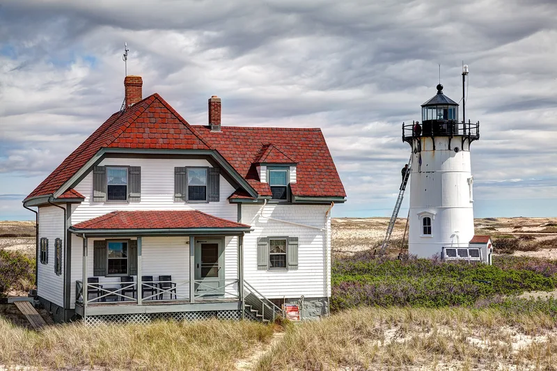
Race Point Light Station sits on Race Point Beach in Provincetown, among large sand dunes about 50 yards from the high water line, and guards the entrance to Provincetown Harbor. The complex centers on a 40-foot white tower of steel plate and brick with a black iron lens room, built in 1876. Nearby are a one-and-a-half-story wood-frame keeper's dwelling begun in 1874-76, a brick oil house from 1876, and a brick building that once housed the steam fog whistle machinery and is now a garage. A light has marked this spot since 1816, and more than 100 wrecks occurred nearby between 1816 and 1946. The station was automated in 1978. It was listed because the group of buildings remains largely intact from the nineteenth century, keeps its original setting and materials, and illustrates the growth of navigation aids in Massachusetts. Though the structures are somewhat deteriorated, the Coast Guard and National Park Service have considered rehabilitation and reuse.
Significance in brief: The nomination argues the station keeps its integrity of location, design, setting, materials and workmanship, and is tied to the development of aids to navigation in Massachusetts. It is described as one of the few intact nineteenth-century light station complexes. It meets criteria A and C at the state level.
Machine-generated summary. This summary was generated by a language model from the official nomination document and has not been reviewed line by line by an editor. It may contain errors. Check the source document before relying on any detail. Source: nomination document (PDF) · National Archives catalog entry. NRHP reference 87001482, listed June 15, 1987. Summary generated October 2026 (model claude-sonnet-5-5, prompt v1.0-2026-10-29, confidence medium).
Key facts
| Address | Race Point Beach, Provincetown |
|---|---|
| County | Barnstable County |
| Listed | June 15, 1987 |
| Reference number | 87001482 |
| Resource type | Structure |
| Criteria |
|
| Areas of significance | Engineering, Transportation, Architecture, Maritime History |
| Level of significance | State |
| Status (as stated in the nomination) | Active but unmanned light, automated in 1978. The keeper's dwelling is described as abandoned and boarded up, and the Coast Guard is developing plans to rehabilitate and reuse the complex with the National Park Service. |
| Acreage | 0.9 |
| Coordinates | 42.06126, -70.24190 (NPS GIS) |
What listing means for this property
For a publicly owned building or structure, listing mainly matters when federal funds, permits or licences are involved: projects then go through Section 106 review so effects on the property are considered. Listing also strengthens applications for preservation grants and, for leased income-producing uses, can enable the federal rehabilitation tax credit.
General information, not legal or tax advice. Rules change; confirm with your State Historic Preservation Office or a qualified adviser.
Sources and further reading
- National Park Service, National Register of Historic Places database (snapshot May 2026), reference 87001482.
- Nomination form (PDF, National Archives) — catalog entry
- Wikipedia article (used for cross-checking only; text not reproduced here)
- Wikidata Q7278912
- This listing as JSON
Last updated October 2026. Found an error? See the editorial policy for how to report it.