Blish-Garret House
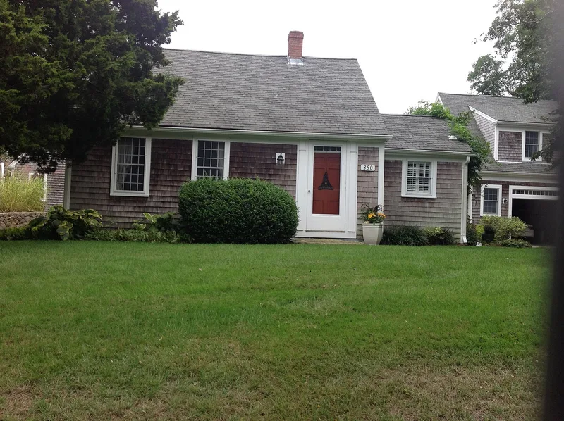

Why it's listed
Set on 4.5 acres at 350 Plum Street in West Barnstable, this story-and-a-half half Cape dates to about 1760 and began as a working farm. Its small central chimney sits almost in line with the front door, which is at one end of the west facade. Trim is plain, the windows are small-paned 12/12 sash built up to the roof eave, and the roof pitch and stone foundation are low. Later ells were added on the south gable end and the east facade. The property runs to the shore of Garretts Pond, which takes its name from Andrew Garrett, who owned the land from 1809 to 1835. Joseph Blish is the first known owner. Owners and villagers used the shoreline for the annual washing of sheep from colonial times into the 1800s, and the families here raised livestock and farmed the land. The house was listed for its link to Barnstable's agricultural past and as an intact vernacular Georgian half-Cape.
Significance in brief: The nomination argues the house reflects Barnstable's early agricultural history and is an intact vernacular example of a Georgian half-Cape. The property reached Garretts Pond, where owners and villagers washed sheep annually from colonial times into the 1800s. It is argued to meet criteria A and C.
Machine-generated summary. This summary was generated by a language model from the official nomination document and has not been reviewed line by line by an editor. It may contain errors. Check the source document before relying on any detail. Source: nomination document (PDF) · National Archives catalog entry. NRHP reference 87000327, listed March 13, 1987. Summary generated October 2026 (model claude-sonnet-5-5, prompt v1.0-2026-10-29, confidence medium).
Key facts
| Address | 350 Plum St., Barnstable |
|---|---|
| County | Barnstable County |
| Listed | March 13, 1987 |
| Reference number | 87000327 |
| Resource type | Building |
| Architectural style | Georgian Cape Cod half house (story and a half) |
| Criteria |
|
| Areas of significance | Agriculture, Architecture |
| Level of significance | Local |
| Status (as stated in the nomination) | Recorded in 1986 as in good condition, in use as a residence, with no major alterations noted. |
| Acreage | 4.5 |
| Coordinates | 41.69477, -70.35522 (NPS GIS) |
What listing means for this property
National Register listing is honorary for a privately owned home: it does not by itself restrict what an owner may do with their own money, and it does not require public access. Restrictions come from local landmark or historic-district ordinances, which are separate (how they differ).
Owner-occupied houses are not eligible for the 20% federal rehabilitation tax credit, which applies to income-producing buildings, but many states offer credits for homeowners. Listing also opens the door to preservation easements and to buying a plaque. Start with what listing means for homeowners, renovating a listed house and selling one.
General information, not legal or tax advice. Rules change; confirm with your State Historic Preservation Office or a qualified adviser.
Sources and further reading
- National Park Service, National Register of Historic Places database (snapshot May 2026), reference 87000327.
- Nomination form (PDF, National Archives) — catalog entry
- Wikipedia article (used for cross-checking only; text not reproduced here)
- Wikidata Q4926812
- This listing as JSON
Last updated October 2026. Found an error? See the editorial policy for how to report it.