West Barnstable Village-Meetinghouse Way Historic District

Why it's listed
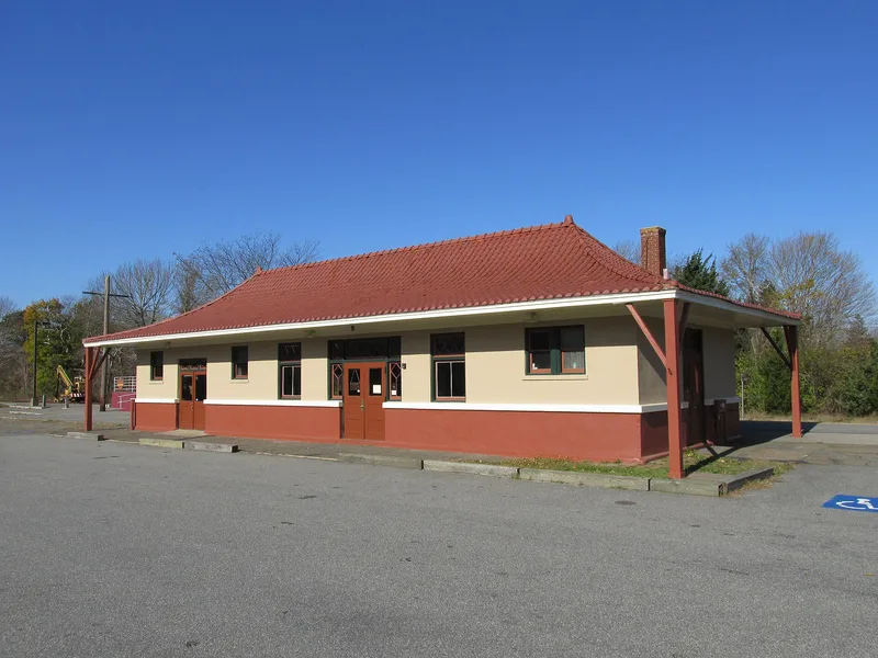
Meetinghouse Way in West Barnstable forms a dispersed linear village of old homesteads mixed with later civic and commercial buildings. The district covers about 175 acres and includes 26 main buildings, outbuildings and several sites dated between 1717 and about 1920. Its anchor is the West Parish Meetinghouse, built in 1717-1719 when residents separated from the original parish at Lothrop's Hill; it was remodelled in the 1850s and restored between 1953 and 1956. Most houses are Federal-era farmhouses built by families such as the Crockers, Parkers and Bodfishes. The Cape Cod Branch Railroad arrived in 1854 and brought a station, school, post office, stores and workshops. Later brick, chair, hat, leather and pottery making, and cranberry cultivation, drew Finnish and Portuguese immigrants. Buildings such as the 1905-1907 Makepeace office and the 1910 concrete railroad depot show this commercial growth. Together they give a continuous picture of village life over several centuries.
Significance in brief: As the second part of Barnstable to be settled, West Barnstable Village kept its prosperity and community focus through several centuries of change. Political, religious, institutional and economic activity drew prominent local families and immigrant groups, and the district's architecture reflects this. The West Parish Meetinghouse of 1717 is its most significant building.
Machine-generated summary. This summary was generated by a language model from the official nomination document and has not been reviewed line by line by an editor. It may contain errors. Check the source document before relying on any detail. Source: nomination document (PDF) · National Archives catalog entry. NRHP reference 87000255, listed November 10, 1987. Summary generated October 2026 (model claude-sonnet-5-5, prompt v1.0-2026-10-29, confidence medium).
Key facts
| Address | Meetinghouse Way from County Rd. to Meetinghouse, Barnstable |
|---|---|
| County | Barnstable County |
| Listed | November 10, 1987 |
| Reference number | 87000255 |
| Resource type | District |
| Period of significance | 1717-1920 |
| Architectural style | Georgian, Federal, Greek Revival/Italianate, Queen Anne, Colonial Revival and Arts & Crafts/Mission |
| Criteria |
|
| Areas of significance | Industry, Commerce, Architecture, Religion |
| Level of significance | National, State, Local |
| Status (as stated in the nomination) | General condition is described as poor to excellent; present uses are residential, institutional and commercial. The 1769 town poor house was demolished in the 1960s. |
| Acreage | 175 |
| Coordinates | 41.70249, -70.37824 (NPS GIS) |
What listing means for this property
This is a historic district. Buildings within its boundary are either contributing (they add to the district's significance) or non-contributing. Owners of contributing income-producing buildings can claim the 20% federal rehabilitation tax credit; homeowners should look at state credits. National Register districts impose no design review by themselves; a local historic district ordinance, if one exists, does (the difference explained).
General information, not legal or tax advice. Rules change; confirm with your State Historic Preservation Office or a qualified adviser.
Sources and further reading
- National Park Service, National Register of Historic Places database (snapshot May 2026), reference 87000255.
- Nomination form (PDF, National Archives) — catalog entry
- Wikipedia article (used for cross-checking only; text not reproduced here)
- Wikidata Q7984396
- This listing as JSON
Last updated October 2026. Found an error? See the editorial policy for how to report it.