Sheridan Park Historic District

Why it's listed
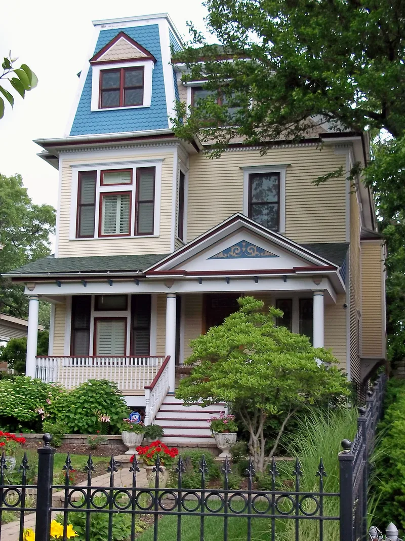
Sheridan Park is a Chicago residential neighborhood on the city's north side, lying along a sandy ridge between Graceland and St. Boniface cemeteries. Its 369 buildings were put up between 1891 and 1929 on large lots, mostly fifty feet wide, laid out by early subdividers. Large suburban-style Victorian houses came first, followed by walk-up apartments, especially six-flats, of which 103 remain. A small number of courtyard buildings and apartment hotels, including the twelve-story Norman Hotel, came in the 1910s and 1920s. Dover Street, resubdivided into narrower lots, has a smaller scale and a more English-influenced character. Consistent setbacks and building heights hold the area together despite its variety. Postwar conversions to rooming houses, resided frame houses, lost cornices and vacant land have affected some blocks. Only fifteen buildings are counted as intrusive, and the nomination treats that as evidence of the district's integrity. Local opinion on listing was divided at the time.
Significance in brief: The nomination argues the district is a clearly defined neighborhood with a distinctive mix of house and apartment types, remarkably free of intrusions. The 50-foot lots laid out by subdividers shaped each wave of development, giving a consistent scale and suburban-style setbacks. Only 15 buildings are listed as intrusive, which the form cites as evidence of integrity.
Machine-generated summary. This summary was generated by a language model from the official nomination document and has not been reviewed line by line by an editor. It may contain errors. Check the source document before relying on any detail. Source: nomination document (PDF) · National Archives catalog entry. NRHP reference 85003352, listed December 27, 1985. Summary generated October 2026 (model claude-sonnet-5-5, prompt v1.0-2026-10-29, confidence medium).
Key facts
| Address | Roughly bounded by Lawrence, Racine, and Montrose Aves., and Clark St., Chicago |
|---|---|
| County | Cook County |
| Listed | December 27, 1985 |
| Reference number | 85003352 |
| Resource type | District |
| Architect / builder | Walter (corner buildings at Montrose and Clark); Steinbach & Lampe (the Montrose, 4405-09 Clark); Johnson & Johnson (Issel Building); Ira Saxe (store-and-flats row, 4600 block of Clark) |
| Architectural style | Mixed Victorian-era styles (stick, shingle, Queen Anne, Colonial Revival), Tudor/Gothic elements, Prairie School, six-flats, courtyard apartments and apartment hotels |
| Areas of significance | Community Planning and Development, Architecture |
| Level of significance | Local |
| Status (as stated in the nomination) | Condition varies from abandoned shells to prize-winning rehabilitations; about eight percent of the land is vacant, and many frame houses have been resided. |
| Acreage | 117 |
| Coordinates | 41.96546, -87.66314 (NPS GIS) |
What listing means for this property
This is a historic district. Buildings within its boundary are either contributing (they add to the district's significance) or non-contributing. Owners of contributing income-producing buildings can claim the 20% federal rehabilitation tax credit; homeowners should look at state credits. National Register districts impose no design review by themselves; a local historic district ordinance, if one exists, does (the difference explained).
General information, not legal or tax advice. Rules change; confirm with your State Historic Preservation Office or a qualified adviser.
Sources and further reading
- National Park Service, National Register of Historic Places database (snapshot May 2026), reference 85003352.
- Nomination form (PDF, National Archives) — catalog entry
- Wikipedia article (used for cross-checking only; text not reproduced here)
- Wikidata Q85800807
- This listing as JSON
Last updated October 2026. Found an error? See the editorial policy for how to report it.