Morrow Plots, University of Illinois

Why it's listed
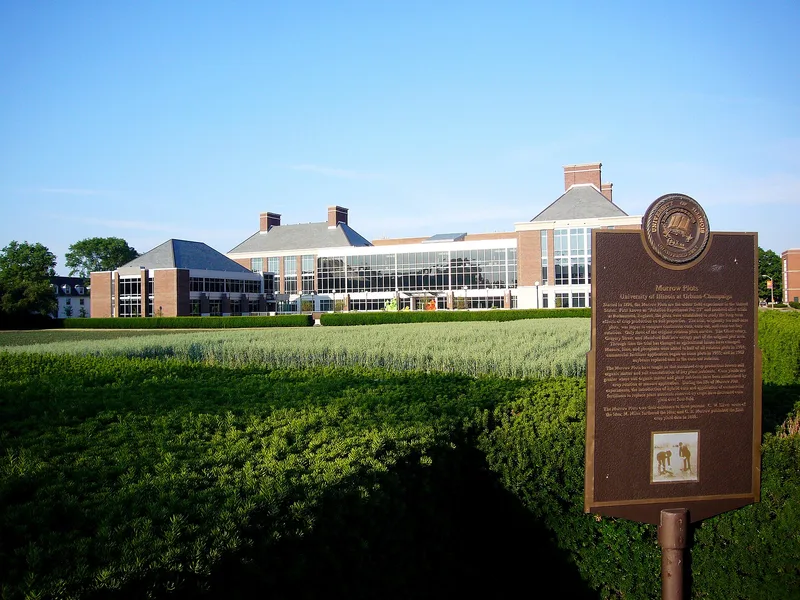
Set in the middle of the University of Illinois campus in Urbana, the Morrow Plots are a small fenced field where crops have been grown under test since 1876. Prof. Manly Miles laid out the first three half-acre plots, named for George E. Morrow, a strong supporter of the work. Seven more plots were added in 1879, and in 1903 and 1904 the field was cut back to six plots of one-tenth acre each to make room for campus expansion. Three cropping systems are compared: continuous corn, a corn-oats rotation, and a corn-oats-red clover rotation. Since 1904 half of each pair has received manure, limestone and phosphorus. The experiments showed that repeated planting of the same crop lowers the productivity of prairie soil, that rotation guards against exhaustion, and that worn soil can be restored with treatment. Agronomy textbooks have long cited the results, and the plots continue to yield data today.
Significance in brief: The plots were the first field experiment plots established by a college in the United States. They helped prove that continuous corn cropping depletes prairie soil and that crop rotation prevents soil exhaustion. They still supply data on rotation and on organic and chemical soil treatments.
Machine-generated summary. This summary was generated by a language model from the official nomination document and has not been reviewed line by line by an editor. It may contain errors. Check the source document before relying on any detail. Source: nomination document (PDF) · National Archives catalog entry. NRHP reference 68000024, listed May 23, 1968. Summary generated October 2026 (model claude-sonnet-5-5, prompt v1.0-2026-10-29, confidence medium).
Key facts
| Address | Gregory Dr. at Matthews Ave., Urbana |
|---|---|
| County | Champaign County |
| Listed | May 23, 1968 |
| Reference number | 68000024 |
| Resource type | Site |
| Period of significance | 1900- (specific date 1876) |
| Areas of significance | Agriculture |
| Level of significance | National |
| National Historic Landmark | Yes, designated May 23, 1968 |
| Status (as stated in the nomination) | Still in cultivation as six 1/10-acre plots inside a fenced area; the form lists the property as occupied and in agricultural use. |
| Acreage | 1.3 |
| Coordinates | 40.10448, -88.22587 (NPS GIS) |
What listing means for this property
Sites (archaeological sites, battlefields, landscapes) are often listed with a restricted address to protect them from looting or disturbance. Listing is honorary for private owners; federal undertakings on or near the site go through Section 106 review, and state laws may protect burials and artefacts regardless of listing.
General information, not legal or tax advice. Rules change; confirm with your State Historic Preservation Office or a qualified adviser.
Sources and further reading
- National Park Service, National Register of Historic Places database (snapshot May 2026), reference 68000024.
- Nomination form (PDF, National Archives) — catalog entry
- Wikipedia article (used for cross-checking only; text not reproduced here)
- Wikidata Q3324432
- This listing as JSON
Last updated October 2026. Found an error? See the editorial policy for how to report it.