Martin Luther King, Jr. Historic District (Boundary Increase)

Why it's listed
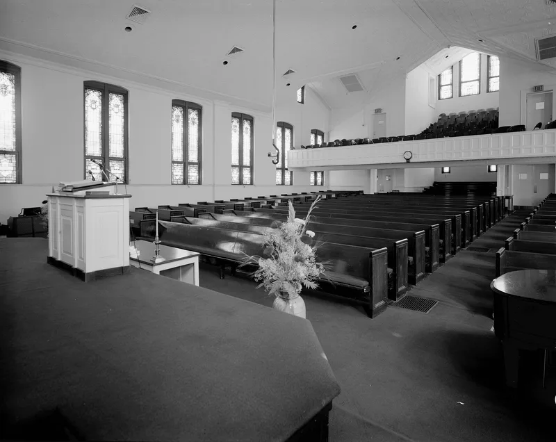
This amended historic district covers roughly 280 acres of the Auburn Avenue neighborhood in Atlanta, east of the Interstate 75/85 corridor. It enlarges the district first listed in 1974 and extends its period of significance to 1968. Most of its 482 contributing resources are single-family houses, along with duplexes, apartment buildings, churches, schools, commercial blocks on Edgewood and Auburn avenues, and industrial sites beside the Southern Railroad. Development occurred in three phases: an integrated late 19th-century neighborhood, a substantial early 20th-century phase after the area became a large black residential enclave, and mid-century low-income apartment construction. The 1917 Atlanta fire destroyed much of the area north of Auburn Avenue, prompting rebuilding in the following decade. Martin Luther King, Jr., grew up here and later worked and worshiped at Ebenezer Baptist Church. The district is valued for that connection, for its role in the Civil Rights Movement, and for the community's history.
Significance in brief: The district is significant for its connection to Martin Luther King, Jr., who grew up there in the 1930s and early 1940s and returned to Atlanta in 1960, and for its link to the American Civil Rights Movement. It also reflects the neighborhood's change from an integrated residential area in the late 19th century to a mixed-use, largely black community of key importance from the 1910s through the Civil Rights era.
Machine-generated summary. This summary was generated by a language model from the official nomination document and has not been reviewed line by line by an editor. It may contain errors. Check the source document before relying on any detail. Source: nomination document (PDF) · National Archives catalog entry. NRHP reference 00000741, listed June 21, 2001. Summary generated October 2026 (model claude-sonnet-5-5, prompt v1.0-2026-10-29, confidence medium).
Key facts
| Address | Roughly bounded by Freedom Pkwy., John Wesley Dobbs Ave., Decatur St., Southern RR tracks, and I-75/85, Atlanta |
|---|---|
| County | Fulton County |
| Listed | June 21, 2001 |
| Reference number | 00000741 |
| Resource type | District |
| Period of significance | c. 1853-1968 |
| Architect / builder | Alexander D. Hamilton and Son; Pharrow Construction Company (builders of some houses) |
| Architectural style | Late Victorian (Queen Anne, Italianate, Gothic, Romanesque); Bungalow/Craftsman; Moderne; International Style |
| Areas of significance | Ethnic Heritage-Black, Social History, Community Planning and Development, Commerce, Architecture, Religion, Landscape Architecture, Education, Industry, Transportation |
| Level of significance | National, State, Local |
| Status (as stated in the nomination) | Current uses include dwellings, commercial buildings, churches, schools, a museum and manufacturing, and some resources are vacant or not in use. |
| Acreage | 280 |
| Coordinates | 33.75523, -84.37573 (NPS GIS) |
What listing means for this property
This is a historic district. Buildings within its boundary are either contributing (they add to the district's significance) or non-contributing. Owners of contributing income-producing buildings can claim the 20% federal rehabilitation tax credit; homeowners should look at state credits. National Register districts impose no design review by themselves; a local historic district ordinance, if one exists, does (the difference explained).
General information, not legal or tax advice. Rules change; confirm with your State Historic Preservation Office or a qualified adviser.
Sources and further reading
- National Park Service, National Register of Historic Places database (snapshot May 2026), reference 00000741.
- Nomination form (PDF, National Archives) — catalog entry
- Wikipedia article (used for cross-checking only; text not reproduced here)
- Wikidata Q5016739
- This listing as JSON
Last updated October 2026. Found an error? See the editorial policy for how to report it.