Tharp's Log

Why it's listed
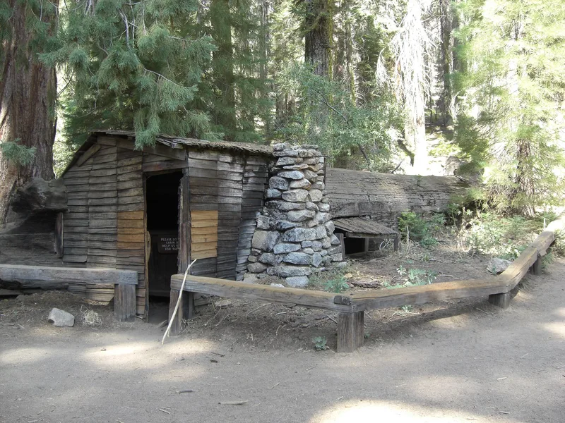
Tharp's Log is a fallen giant sequoia, hollowed by fire, lying on the northern edge of Log Meadow in the Giant Forest of Sequoia National Park. About 55 feet of the hollow trunk is large enough for people, and it was fitted out as a cabin with a shake-enclosed west end, a fireplace of local granite boulders, a shuttered window with horseshoe hinges, and a bed, table and bench made of redwood slabs. Local pioneer Hale Tharp entered Giant Forest in 1858, the first recorded entry by a non-Native person, and carved his name on the log. Shortly after 1860 he began grazing cattle in the meadows each summer and used the log as a cabin, as did several hired hands, until the park was established in 1890. The National Park Service bought the surrounding 120 acres in 1920 and opened the cabin to the public. It was restored in the 1930s, served as a trailside museum, and was partly rebuilt in the early 1950s.
Significance in brief: The nomination argues local significance in exploration and settlement. It was the summer cattle camp of Hale Tharp, the first European man to enter and explore Giant Forest, and was apparently the first cabin built in the middle and upper elevations of what is now Sequoia National Park.
Machine-generated summary. This summary was generated by a language model from the official nomination document and has not been reviewed line by line by an editor. It may contain errors. Check the source document before relying on any detail. Source: nomination document (PDF) · National Archives catalog entry. NRHP reference 77000117, listed March 8, 1977. Summary generated October 2026 (model claude-sonnet-5-5, prompt v1.0-2026-10-29, confidence high).
Key facts
| Address | NE of Three Rivers, Three Rivers |
|---|---|
| County | Tulare County |
| Listed | March 8, 1977 |
| Reference number | 77000117 |
| Resource type | Building |
| Period of significance | 1800-1899 |
| Architect / builder | Hale Tharp |
| Areas of significance | Exploration/Settlement |
| Level of significance | Local |
| Status (as stated in the nomination) | Condition rated good and original site; used as a park museum/display, publicly accessible without restriction. Restored in the early 1930s and apparently partly rebuilt in the early 1950s. |
| Acreage | 0.9 |
| Coordinates | 36.56109, -118.74245 (NPS GIS) |
What listing means for this property
National Register listing is honorary: it recognises significance and does not restrict what a private owner may do without federal money or permits. It unlocks the 20% federal rehabilitation tax credit for income-producing buildings, state credits in many states, and Section 106 review when federal agencies are involved. See what listing means in practice.
General information, not legal or tax advice. Rules change; confirm with your State Historic Preservation Office or a qualified adviser.
Sources and further reading
- National Park Service, National Register of Historic Places database (snapshot May 2026), reference 77000117.
- Nomination form (PDF, National Archives) — catalog entry
- Wikipedia article (used for cross-checking only; text not reproduced here)
- Wikidata Q7710807
- This listing as JSON
Last updated October 2026. Found an error? See the editorial policy for how to report it.