San Francisco-Oakland Bay Bridge (Additional Documentation)
Also known as: Bay Bridge

The pin is a point inside the NPS boundary polygon, not a surveyed location.
Why it's listed
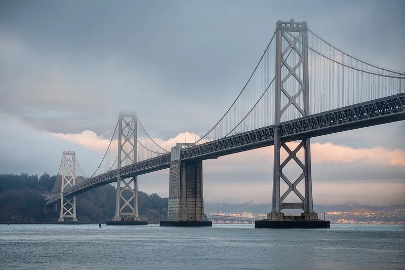
Spanning San Francisco Bay between San Francisco and Oakland, the Bay Bridge opened in 1936 as the longest bridge in the world. It links five segments: the San Francisco approach, a West Bay crossing of two back-to-back suspension spans, a tunnel and viaducts through Yerba Buena Island, an East Bay crossing, and the Oakland approach. Built of steel and reinforced concrete, it originally carried automobiles on the upper deck and trucks plus interurban trains on the lower deck. Changes in the late 1950s removed the rail tracks and converted both decks to one-way car and truck traffic. The bridge is recognized for engineering and transportation. Its double-suspension design was considered the first of its kind, and its deep piers and varied bridge types responded to poor seabed conditions. Construction also provided work during the Great Depression. Associated resources include a granite-faced transit terminal and Key System electrical substations.
Significance in brief: The nomination argues the bridge is significant for engineering and transportation. It was the longest bridge in the world when built and combined several bridge types in one structure. Its double-suspension West Bay crossing was considered the first of its kind, and its design answered poor foundation conditions on the bay floor. It also carried automobile, truck and interurban rail traffic and provided Depression-era jobs.
Machine-generated summary. This summary was generated by a language model from the official nomination document and has not been reviewed line by line by an editor. It may contain errors. Check the source document before relying on any detail. Source: nomination document (PDF) · National Archives catalog entry. NRHP reference 00000525, listed August 13, 2001. Summary generated October 2026 (model claude-sonnet-5-5, prompt v1.0-2026-10-29, confidence medium).
Key facts
| Address | I-80, San Francisco |
|---|---|
| County | San Francisco |
| Listed | August 13, 2001 |
| Reference number | 00000525 |
| Resource type | Structure |
| Period of significance | 1936 |
| Architect / builder | Purcell, Charles H.; Andrew, Charles E.; Woodruff, Glenn B. |
| Architectural style | Other: Combination cantilever-truss/suspension-truss spans and tunnel |
| Criteria |
|
| Areas of significance | Architecture, Engineering |
| Level of significance | National |
| Status (as stated in the nomination) | Still carries road traffic. Rail service was removed in the late 1950s and the decks were converted to one-way mixed car and truck traffic. Original Oakland approaches no longer remain. |
| Acreage | 30 |
| Coordinates | 37.80437, -122.36135 (NPS GIS) |
What listing means for this property
For a publicly owned building or structure, listing mainly matters when federal funds, permits or licences are involved: projects then go through Section 106 review so effects on the property are considered. Listing also strengthens applications for preservation grants and, for leased income-producing uses, can enable the federal rehabilitation tax credit.
General information, not legal or tax advice. Rules change; confirm with your State Historic Preservation Office or a qualified adviser.
Sources and further reading
- National Park Service, National Register of Historic Places database (snapshot May 2026), reference 00000525.
- Nomination form (PDF, National Archives) — catalog entry
- Wikipedia article (used for cross-checking only; text not reproduced here)
- Wikidata Q771404
- This listing as JSON
Last updated October 2026. Found an error? See the editorial policy for how to report it.