Fort Miley Military Reservation
Also known as: Point Lobos Military Reservation; East Fort Miley; West Fort M

Why it's listed
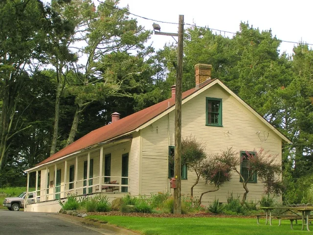
Fort Miley occupies Point Lobos, one of the outer headlands at the south side of the Golden Gate. The Army acquired the 54-acre reservation from the City and County of San Francisco in 1893 and began building gun and mortar batteries in 1899. Battery Chester, in the western section, held three 12-inch guns, while Batteries Livingston and Springer, in the east, were a sixteen-mortar battery later divided in two. Later additions included a 1913 searchlight power plant, fire control stations and a 6-inch gun battery completed in 1944. Most weapons were removed by 1943, though some guns lasted until about 1950. The wooden garrison buildings were demolished by 1934 and a Veterans Administration hospital now covers that central area, so the district is split into East and West Fort Miley. A 1902 ordnance storehouse survives as the last post building. The works are considered nationally significant for their role in defending San Francisco Bay.
Significance in brief: The batteries, fire control stations and searchlight facilities were part of the defense of San Francisco Harbor, regarded by army planners as the most important harbor on the West Coast. Point Lobos fortification marked the final phase of the Endicott system, placing guns farther seaward on the outer line of defense. The works remained in service through World War II.
Machine-generated summary. This summary was generated by a language model from the official nomination document and has not been reviewed line by line by an editor. It may contain errors. Check the source document before relying on any detail. Source: nomination document (PDF) · National Archives catalog entry. NRHP reference 80000371, listed May 23, 1980. Summary generated October 2026 (model claude-sonnet-5-5, prompt v1.0-2026-10-29, confidence medium).
Key facts
| Address | Off CA 1, San Francisco |
|---|---|
| County | San Francisco |
| Listed | May 23, 1980 |
| Reference number | 80000371 |
| Resource type | District |
| Period of significance | 1892-1950 |
| Architect / builder | United States Army |
| Areas of significance | Military |
| Level of significance | State |
| Status (as stated in the nomination) | Public park land within Golden Gate National Recreation Area; batteries in good condition, with East Fort Miley used for park maintenance and a Park Police office and stable. The central former garrison site is occupied by a Veterans Administration hospital and excluded. |
| Acreage | 27.5 |
| Coordinates | 37.78257, -122.50545 (NPS GIS) |
What listing means for this property
This is a historic district. Buildings within its boundary are either contributing (they add to the district's significance) or non-contributing. Owners of contributing income-producing buildings can claim the 20% federal rehabilitation tax credit; homeowners should look at state credits. National Register districts impose no design review by themselves; a local historic district ordinance, if one exists, does (the difference explained).
General information, not legal or tax advice. Rules change; confirm with your State Historic Preservation Office or a qualified adviser.
Sources and further reading
- National Park Service, National Register of Historic Places database (snapshot May 2026), reference 80000371.
- Nomination form (PDF, National Archives) — catalog entry
- Wikipedia article (used for cross-checking only; text not reproduced here)
- Wikidata Q5471680
- This listing as JSON
Last updated October 2026. Found an error? See the editorial policy for how to report it.