Golden Gate Park

Why it's listed
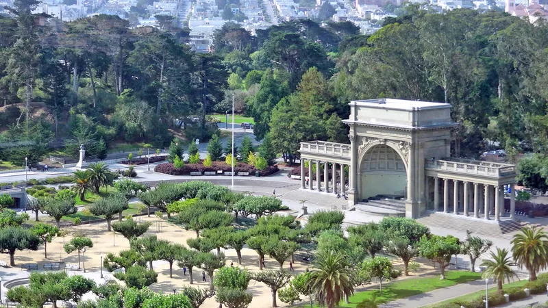
Golden Gate Park covers 1,017 acres on the western side of San Francisco, running about 3.5 miles from the city center to the Pacific Ocean. Surveyed in 1870 by William Hammond Hall on windblown sand dunes known as the Outside Lands, it was transformed through a major reclamation effort into a man-made forest of more than 30,000 trees, broken by open meadows and linked by curving roads and paths. Hall served as the first superintendent, and John McLaren carried the plan forward for 53 years after 1889. The design follows the picturesque tradition influenced by Frederick Law Olmsted Sr. Lakes, gardens, the Conservatory of Flowers, the Music Concourse, the Japanese Tea Garden, monuments, and 1930s public works facilities were added over time. The park was listed as a historic district with 135 contributing resources. Its original spatial layout of forest, meadow and road system remains largely intact, and visitors still picnic, stroll, boat and play sports much as earlier generations did.
Significance in brief: The nomination presents the park as a picturesque, Olmsted-influenced designed landscape, created by turning windswept sand dunes into a forest and meadows linked by curving roads and paths. It was conceived as a single unified work, with a high degree of integrity. Its many gardens, lakes, monuments and recreation facilities reflect over a century of development under superintendents Hall and John McLaren.
Machine-generated summary. This summary was generated by a language model from the official nomination document and has not been reviewed line by line by an editor. It may contain errors. Check the source document before relying on any detail. Source: nomination document (PDF) · National Archives catalog entry. NRHP reference 04001137, listed October 15, 2004. Summary generated October 2026 (model claude-sonnet-5-5, prompt v1.0-2026-10-29, confidence medium).
Key facts
| Address | Bounded by Fulton St., Stanyan St., Fell St., Baker St., Oak St., Lincoln Way and The Great Highway, San Francisco |
|---|---|
| County | San Francisco |
| Listed | October 15, 2004 |
| Reference number | 04001137 |
| Resource type | District |
| Architect / builder | William Hammond Hall (original plan and first superintendent); John McLaren (superintendent 1889-1943) |
| Architectural style | Mid-late 19th Century picturesque park landscape; Olmsted-influenced landscape |
| Areas of significance | Landscape Architecture, Entertainment/Recreation, Social History |
| Level of significance | National |
| Status (as stated in the nomination) | Remains in use as a public park; the framework of roads, forest and meadows survives. The de Young Museum and California Academy of Sciences were replacing their historic structures at the time of the form. |
| Acreage | 1017 |
| Coordinates | 37.76913, -122.47964 (NPS GIS) |
What listing means for this property
This is a historic district. Buildings within its boundary are either contributing (they add to the district's significance) or non-contributing. Owners of contributing income-producing buildings can claim the 20% federal rehabilitation tax credit; homeowners should look at state credits. National Register districts impose no design review by themselves; a local historic district ordinance, if one exists, does (the difference explained).
General information, not legal or tax advice. Rules change; confirm with your State Historic Preservation Office or a qualified adviser.
Sources and further reading
- National Park Service, National Register of Historic Places database (snapshot May 2026), reference 04001137.
- Nomination form (PDF, National Archives) — catalog entry
- Wikipedia article (used for cross-checking only; text not reproduced here)
- Wikidata Q635559
- This listing as JSON
Last updated October 2026. Found an error? See the editorial policy for how to report it.