Fort Point National Historic Site

Why it's listed
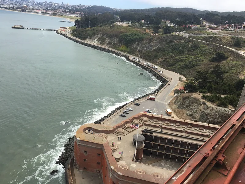
Fort Point is a four-story masonry fort on the promontory at the northern end of the San Francisco Peninsula, facing the Golden Gate. Built in 1853 by the U.S. Army Engineers to protect San Francisco Harbor, it is made of brick trimmed with granite and was designed after Fort Sumter. Some walls are 36 feet thick. A courtyard is surrounded on three sides by galleries of tiered brick arches, and spiral granite stairways rise in three towers. An octagonal metal lighthouse sits atop the northwest tower. The fort held 149 guns in four tiers, and rainwater from the roof was channeled to a double cistern below. The site had earlier defenses, including the Spanish adobe Castillo de San Joaquin of 1794. The fort was declared obsolete in 1905, its batteries were abandoned in 1914, and the Golden Gate Bridge has overshadowed it since 1937. It was renamed Fort Winfield Scott after 1882 and became a national historic site in 1970.
Significance in brief: The fort is a brick and granite coastal defense work designed after Fort Sumter, with walls up to 36 feet thick. It is noted for its masonry, spiral granite stairways and parabolic brick vaults. It also marks a long sequence of harbor defense on the site, from a Spanish adobe fort in 1794 to the Army post that was declared obsolete in 1905.
Machine-generated summary. This summary was generated by a language model from the official nomination document and has not been reviewed line by line by an editor. It may contain errors. Check the source document before relying on any detail. Source: nomination document (PDF) · National Archives catalog entry. NRHP reference 70000146, listed October 16, 1970. Summary generated October 2026 (model claude-sonnet-5-5, prompt v1.0-2026-10-29, confidence medium).
Key facts
| Address | N tip of San Francisco Peninsula on U.S. 101 and I 480, San Francisco |
|---|---|
| County | San Francisco |
| Listed | October 16, 1970 |
| Reference number | 70000146 |
| Resource type | District |
| Architect / builder | U.S. Engineers (architect and builder) |
| Architectural style | Federal |
| Areas of significance | Military, Architecture, Maritime History |
| Level of significance | National |
| Status (as stated in the nomination) | Physical condition listed as fair; present use listed as none (not used). Owned by the National Park Service, with a proposed use as a museum and point of interest. |
| Acreage | 29 |
| Coordinates | 37.81053, -122.47669 (NPS GIS) |
What listing means for this property
This is a historic district. Buildings within its boundary are either contributing (they add to the district's significance) or non-contributing. Owners of contributing income-producing buildings can claim the 20% federal rehabilitation tax credit; homeowners should look at state credits. National Register districts impose no design review by themselves; a local historic district ordinance, if one exists, does (the difference explained).
Noted as vacant in the nomination. Nomination documents can be decades old; current status may differ. If you are considering buying an empty listed property, read the due-diligence checklist.
General information, not legal or tax advice. Rules change; confirm with your State Historic Preservation Office or a qualified adviser.
Sources and further reading
- National Park Service, National Register of Historic Places database (snapshot May 2026), reference 70000146.
- Nomination form (PDF, National Archives) — catalog entry
- Wikipedia article (used for cross-checking only; text not reproduced here)
- Wikidata Q1438659
- This listing as JSON
Last updated October 2026. Found an error? See the editorial policy for how to report it.