Torrey Pines Park Road
Also known as: Roosevelt Memorial Drive

Why it's listed
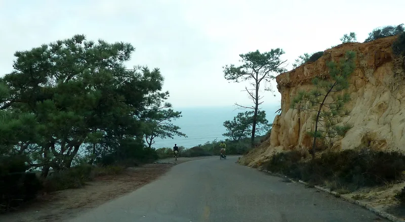
Torrey Pines Park Road is a two-mile road climbing Torrey Pines Grade through Torrey Pines State Reserve in San Diego. It began as part of the Coast Highway, with concrete paving completed in 1915 when the road was graded. The lower public section now has an asphalt surface laid over the original 18-foot concrete slab, while the southern part still shows its 1915 pavement. Original features include seven storm drains, some built with cobblestone, and scored lines in the concrete that gave cars better traction on steep curves. The concrete mix contains seashell fragments, possibly from ancient shell middens at a nearby quarry site. Major traffic was rerouted to a wider four-lane highway around 1932-1933, and the old road became the park road. It is listed for its place in regional transportation history and for its early road engineering. The state park system maintains it today.
Significance in brief: The form lists the road under Criteria A and C, with Transportation and Engineering as areas of significance, for the period 1915-1933. It records the 1915 completion and grading of the road and its role as the 'Gateway to San Diego' until major traffic was rerouted to an adjacent road in 1933. Surviving original concrete pavement, storm drains and the winding grade carry that history.
Machine-generated summary. This summary was generated by a language model from the official nomination document and has not been reviewed line by line by an editor. It may contain errors. Check the source document before relying on any detail. Source: nomination document (PDF) · National Archives catalog entry. NRHP reference 98001248, listed October 22, 1998. Summary generated October 2026 (model claude-sonnet-5-5, prompt v1.0-2026-10-29, confidence medium).
Key facts
| Address | Roughly the North/South R. within Torrey Pines State Reserve, San Diego |
|---|---|
| County | San Diego County |
| Listed | October 22, 1998 |
| Reference number | 98001248 |
| Resource type | Structure |
| Period of significance | 1915-1933 |
| Criteria |
|
| Areas of significance | Transportation, Engineering |
| Level of significance | State |
| Status (as stated in the nomination) | Still used as a road within the Reserve; the northern section is open to the public and the southern section is a limited-access service road. It is no longer a through road. |
| Acreage | 4 |
| Coordinates | 32.91919, -117.25101 (NPS GIS) |
What listing means for this property
For a publicly owned building or structure, listing mainly matters when federal funds, permits or licences are involved: projects then go through Section 106 review so effects on the property are considered. Listing also strengthens applications for preservation grants and, for leased income-producing uses, can enable the federal rehabilitation tax credit.
General information, not legal or tax advice. Rules change; confirm with your State Historic Preservation Office or a qualified adviser.
Sources and further reading
- National Park Service, National Register of Historic Places database (snapshot May 2026), reference 98001248.
- Nomination form (PDF, National Archives) — catalog entry
- Wikidata Q6150909
- This listing as JSON
Last updated October 2026. Found an error? See the editorial policy for how to report it.