Keys Desert Queen Ranch
Also known as: McHaney Ranch; Bill Key's Ranch

Why it's listed
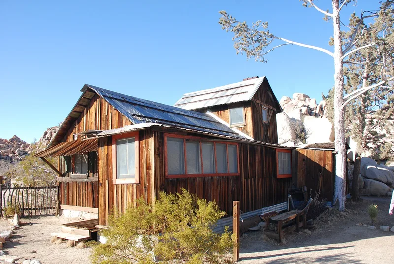
Keys' Desert Queen Ranch is a desert homestead complex southwest of Twentynine Palms, within Joshua Tree National Monument. It includes a two-story frame ranch house, a school house, a guest house, a tack house made from two cyanide tanks, an arrastra, an ore-loading hopper, a windmill, a cemetery, several dams and a large collection of mining and farm machinery. Bill McHaney began the ranch about 1894 with three adobe buildings, and only a fragment of his adobe barn survives. William F. Keys settled in the area after 1910, took over the ranch and built most of the wood-frame buildings from salvaged materials. He ran cattle and livestock, grew fruit, mined, and built dams to capture rainwater. He expanded the homestead from 80 to 240 acres, raised seven children there and arranged teaching on site. The ranch was listed for what it shows of ranching and mining life in the high desert between 1894 and 1969.
Significance in brief: The ranch is argued to be of local historical significance in agriculture and mining. It reflects the career of William F. Keys, described as perhaps the most persistent rancher, farmer and miner in the high desert region. He ran livestock, grew fruit, built many dams to catch scarce rainfall, and prospected and mined, living a lifestyle more unusual than that of typical regional ranchers and miners.
Machine-generated summary. This summary was generated by a language model from the official nomination document and has not been reviewed line by line by an editor. It may contain errors. Check the source document before relying on any detail. Source: nomination document (PDF) · National Archives catalog entry. NRHP reference 75000174, listed October 30, 1975. Summary generated October 2026 (model claude-sonnet-5-5, prompt v1.0-2026-10-29, confidence high).
Key facts
| Address | SW of Twentynine Palms in Joshua Tree National Monument, Twentynine Palms |
|---|---|
| County | San Bernardino County |
| Listed | October 30, 1975 |
| Reference number | 75000174 |
| Resource type | District |
| Period of significance | 1894 - 1969 |
| Architect / builder | Bill McHaney, William F. Keys |
| Areas of significance | Industry, Agriculture |
| Level of significance | Local |
| Status (as stated in the nomination) | Many structures are described as deteriorated, decayed or partly collapsed; the form checks the condition as deteriorated. The Keys-built buildings were flimsy, mostly unpainted and without foundations. |
| Acreage | 160 |
| Coordinates | 34.04455, -116.16767 (NPS GIS) |
What listing means for this property
This is a historic district. Buildings within its boundary are either contributing (they add to the district's significance) or non-contributing. Owners of contributing income-producing buildings can claim the 20% federal rehabilitation tax credit; homeowners should look at state credits. National Register districts impose no design review by themselves; a local historic district ordinance, if one exists, does (the difference explained).
General information, not legal or tax advice. Rules change; confirm with your State Historic Preservation Office or a qualified adviser.
Sources and further reading
- National Park Service, National Register of Historic Places database (snapshot May 2026), reference 75000174.
- Nomination form (PDF, National Archives) — catalog entry
- Wikipedia article (used for cross-checking only; text not reproduced here)
- Wikidata Q14682963
- This listing as JSON
Last updated October 2026. Found an error? See the editorial policy for how to report it.