Barker Dam

Why it's listed
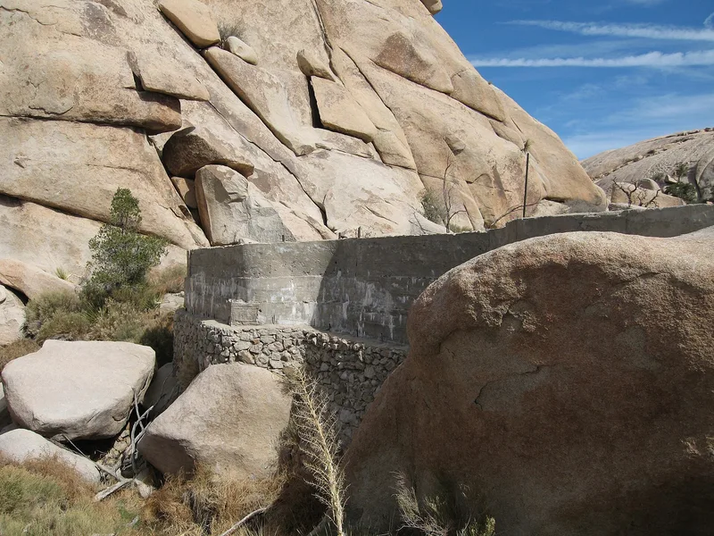
Barker Dam is a stock-watering dam in what is now Joshua Tree National Monument, southwest of Twentynine Palms. Local cattleman C.O. Barker built it in 1900 from cement faced with native stone, standing about nine feet high. Construction required sixteen eight-day trips to haul cement, wooden forms, mixing equipment and other materials from Banning. After 1917, at an unknown date, cattleman William F. Keys obtained the dam and added three feet of concrete, bringing it to twelve feet and increasing the water it could hold. The structure runs about 150 feet and has several indentations in its design. A low dry-stone wall above it kept livestock out of the deeper water, and a pipe feeds a pond of two concentric circular walls below. The dam is considered locally significant in agriculture as a typical example of the structures cattlemen built to capture desert cloudburst runoff, using cement and local rock rather than earth.
Significance in brief: The nomination argues local significance under agriculture. The dam is typical of structures built by cattlemen in arid desert regions to capture rainwater from infrequent cloudbursts for livestock. It served a number of cattlemen over the years, and its use of cement and local rock reflects the rocky terrain, where earthwork dams were less practical.
Machine-generated summary. This summary was generated by a language model from the official nomination document and has not been reviewed line by line by an editor. It may contain errors. Check the source document before relying on any detail. Source: nomination document (PDF) · National Archives catalog entry. NRHP reference 75000173, listed October 29, 1975. Summary generated October 2026 (model claude-sonnet-5-5, prompt v1.0-2026-10-29, confidence medium).
Key facts
| Address | SE of Twentynine Palms in Joshua Tree National Monument, Twentynine Palms |
|---|---|
| County | Riverside County |
| Listed | October 29, 1975 |
| Reference number | 75000173 |
| Resource type | Structure |
| Period of significance | 1900-present |
| Architect / builder | C.O. Barker; W.F. Keys |
| Areas of significance | Agriculture |
| Level of significance | Local |
| Status (as stated in the nomination) | Described as in excellent condition and unaltered at its original site; still serviceable and listed as unoccupied, with present use as park. |
| Acreage | 290 |
| Coordinates | 34.03118, -116.14496 (NPS GIS) |
What listing means for this property
For a publicly owned building or structure, listing mainly matters when federal funds, permits or licences are involved: projects then go through Section 106 review so effects on the property are considered. Listing also strengthens applications for preservation grants and, for leased income-producing uses, can enable the federal rehabilitation tax credit.
General information, not legal or tax advice. Rules change; confirm with your State Historic Preservation Office or a qualified adviser.
Sources and further reading
- National Park Service, National Register of Historic Places database (snapshot May 2026), reference 75000173.
- Nomination form (PDF, National Archives) — catalog entry
- Wikipedia article (used for cross-checking only; text not reproduced here)
- Wikidata Q4860949
- This listing as JSON
Last updated October 2026. Found an error? See the editorial policy for how to report it.