Cow Camp

Why it's listed
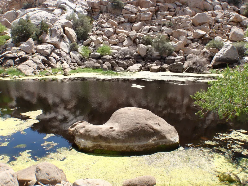
Cow Camp is a small historic site in a boulder-strewn valley of Joshua Tree National Monument, southwest of Twentynine Palms, California. Its importance began with a spring-fed natural pond in otherwise arid high desert. In the late 1880s and early 1890s the McHaney Gang, led by brothers William and James McHaney, used the camp to hold stolen cattle and change their brands with a running iron. Prospectors who camped nearby in 1893 found their horses missing and traced them to the camp, where an armed man pressured them to say nothing had been lost. Outlaw use apparently ended after 1894. In the 1920s William F. Keys used the camp as a line camp for legitimate stock raising and built a concrete dam, 22 feet high and 800 feet long, to increase the water supply. Today the ruins of one building, an old rock-lined well and the intact dam remain on the 80-acre property.
Significance in brief: The nomination argues local significance in agriculture, specifically livestock raising and rustling. The camp served as a hideout and rebranding site for the McHaney Gang of cattle rustlers in the late 1880s and early 1890s. In the 1920s William F. Keys used it as a legitimate line camp and built the dam.
Machine-generated summary. This summary was generated by a language model from the official nomination document and has not been reviewed line by line by an editor. It may contain errors. Check the source document before relying on any detail. Source: nomination document (PDF) · National Archives catalog entry. NRHP reference 75000228, listed October 29, 1975. Summary generated October 2026 (model claude-sonnet-5-5, prompt v1.0-2026-10-29, confidence medium).
Key facts
| Address | SW of Twentynine Palms in Joshua Tree National Monument, Twentynine Palms |
|---|---|
| County | San Bernardino County |
| Listed | October 29, 1975 |
| Reference number | 75000228 |
| Resource type | District |
| Period of significance | 1880s-1920s |
| Architect / builder | James McHaney, William F. Keys |
| Areas of significance | Agriculture |
| Level of significance | Local |
| Status (as stated in the nomination) | Condition is listed as excellent and altered. Only a rubble chimney and stone foundation outline remain of the buildings. The dam is intact and in good condition. The site is federally owned within the park. |
| Acreage | 80 |
| Coordinates | 34.03744, -116.16794 (NPS GIS) |
What listing means for this property
This is a historic district. Buildings within its boundary are either contributing (they add to the district's significance) or non-contributing. Owners of contributing income-producing buildings can claim the 20% federal rehabilitation tax credit; homeowners should look at state credits. National Register districts impose no design review by themselves; a local historic district ordinance, if one exists, does (the difference explained).
General information, not legal or tax advice. Rules change; confirm with your State Historic Preservation Office or a qualified adviser.
Sources and further reading
- National Park Service, National Register of Historic Places database (snapshot May 2026), reference 75000228.
- Nomination form (PDF, National Archives) — catalog entry
- Wikipedia article (used for cross-checking only; text not reproduced here)
- Wikidata Q5179391
- This listing as JSON
Last updated October 2026. Found an error? See the editorial policy for how to report it.