Yosemite Valley

Why it's listed
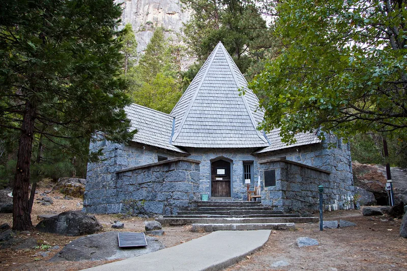
Yosemite Valley is a nine-mile granite gorge in the Sierra Nevada where the Merced River crosses a flat floodplain of meadows and oak and pine woodland, beneath cliffs such as El Capitan and Half Dome. This historic district covers the valley floor from Pohono Bridge to Mirror Lake and Vernal Fall. It includes roads, trails, bridges, stables, comfort stations, meadows, orchards and Camp 4, along with the Yosemite Village, Ahwahnee Hotel and Camp Curry areas. American Indians managed the valley with periodic burning for thousands of years. Tourists arrived in the 1850s, wagon roads followed in the 1870s, and after 1916 the National Park Service built visitor facilities in a rustic style meant to blend with the setting. The district's period of significance ends in 1942, when that program stopped. The valley's development footprint from that year survives, and the district retains exceptional integrity as a long experiment in preserving a natural landscape through park management.
Significance in brief: The nomination argues that the valley floor is a unique cultural landscape shaped by thousands of years of American Indian management and by 150 years of Euro-American tourism, park development and efforts to preserve a 'natural' scene. Its development footprint, in place by 1942, reflects early resort growth and the National Park Service rustic architecture program. The district also holds the Yosemite Village, Ahwahnee Hotel and Camp Curry areas, each significant in its own right.
Machine-generated summary. This summary was generated by a language model from the official nomination document and has not been reviewed line by line by an editor. It may contain errors. Check the source document before relying on any detail. Source: nomination document (PDF) · National Archives catalog entry. NRHP reference 04001159, listed December 14, 2006. Summary generated October 2026 (model claude-sonnet-5-5, prompt v1.0-2026-10-29, confidence medium).
Key facts
| Address | Yosemite National Park, Yosemite |
|---|---|
| County | Mariposa County |
| Listed | December 14, 2006 |
| Reference number | 04001159 |
| Resource type | District |
| Period of significance | 1850s-1942 (the form states 1942 as the end date; the start is described as the 1850s) |
| Architectural style | Bungalow/Craftsman; NPS Rustic |
| Areas of significance | Landscape Architecture, Architecture, Politics/Government, Community Planning and Development, Transportation, Entertainment/Recreation, Conservation |
| Level of significance | National |
| Status (as stated in the nomination) | The valley remains a public park with its historic function and overall footprint intact. The Yosemite Lodge, Housekeeping Camp and campground areas have been redeveloped since 1942 and are non-contributing. |
| Acreage | 3800 |
| Within district | Yosemite Valley Bridges |
| Coordinates | 37.73535, -119.61375 (NPS GIS) |
What listing means for this property
This is a historic district. Buildings within its boundary are either contributing (they add to the district's significance) or non-contributing. Owners of contributing income-producing buildings can claim the 20% federal rehabilitation tax credit; homeowners should look at state credits. National Register districts impose no design review by themselves; a local historic district ordinance, if one exists, does (the difference explained).
General information, not legal or tax advice. Rules change; confirm with your State Historic Preservation Office or a qualified adviser.
Sources and further reading
- National Park Service, National Register of Historic Places database (snapshot May 2026), reference 04001159.
- Nomination form (PDF, National Archives) — catalog entry
- Wikidata Q97024916
- This listing as JSON
Last updated October 2026. Found an error? See the editorial policy for how to report it.