Wasena Historic District
Also known as: Vdhr# 128-6269
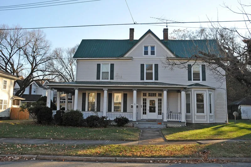

Why it's listed
Wasena is a residential suburb of Roanoke, Virginia, covering about 174 acres south and west of the Roanoke River. The Wasena Land Company platted it in 1910 and 1917 on farmland, and the Wasena Bridge linked it to the original city. Of 469 primary resources, 454 are dwellings, mostly single-family houses built from the early 1900s through the 1950s. Craftsman bungalows are the dominant type, followed by American Foursquares and, after World War II, Ranch houses. Queen Anne, Dutch Colonial Revival, Tudor Revival and Cape Cod examples also appear. Other features include commercial buildings at the north end of Main Street, the 1926 Roanoke Ice and Cold Storage Company building, a 28-acre riverside park, low stone retaining walls and a green space left open because of steep slopes. The 1938-1939 concrete bridge was a Works Progress Administration project. About 94 percent of primary resources contribute to the district, which reflects its planning, architecture, commerce, industry, recreation and transportation.
Significance in brief: The inventory states the district is significant in architecture, community planning, commerce/trade, industry, recreation and transportation. It preserves a largely intact streetcar-era-to-postwar suburb with Craftsman bungalows, American Foursquares and Ranch houses, along with the 1938-1939 Wasena Bridge, a riverside park and an ice plant.
Machine-generated summary. This summary was generated by a language model from the official nomination document and has not been reviewed line by line by an editor. It may contain errors. Check the source document before relying on any detail. Source: nomination document (PDF) · National Archives catalog entry. NRHP reference 11000984, listed January 3, 2012. Summary generated October 2026 (model claude-sonnet-5-5, prompt v1.0-2026-10-29, confidence medium).
Key facts
| Address | Wiley Dr., Winchester, Winona, Wasena, Howbert, Valley, Hamilton, Kerns, Floyd & Summit Aves., Brighton Rd., Roanoke (Independent City) |
|---|---|
| County | Roanoke (city and county) |
| Listed | January 3, 2012 |
| Reference number | 11000984 |
| Resource type | District |
| Period of significance | ca. 1900-1960 |
| Architectural style | Bungalow/Craftsman, Colonial Revival, Prairie School, Tudor Revival, Ranch |
| Areas of significance | Architecture, Community Planning and Development, Transportation, Commerce, Industry, Entertainment/Recreation |
| Level of significance | Local |
| Status (as stated in the nomination) | Retains a relatively high level of integrity: 443 of 469 primary resources (94%) contribute. Alterations are mostly siding, replacement windows and porch changes. Current functions still include dwellings, businesses, industrial storage, recreation and the bridge. |
| Acreage | 174 |
| Coordinates | 37.26441, -79.96204 (NPS GIS) |
What listing means for this property
This is a historic district. Buildings within its boundary are either contributing (they add to the district's significance) or non-contributing. Owners of contributing income-producing buildings can claim the 20% federal rehabilitation tax credit; homeowners should look at state credits. National Register districts impose no design review by themselves; a local historic district ordinance, if one exists, does (the difference explained).
General information, not legal or tax advice. Rules change; confirm with your State Historic Preservation Office or a qualified adviser.
Sources and further reading
- National Park Service, National Register of Historic Places database (snapshot May 2026), reference 11000984.
- Nomination form (PDF, National Archives) — catalog entry
- Wikipedia article (used for cross-checking only; text not reproduced here)
- Wikidata Q16902959
- This listing as JSON
Last updated October 2026. Found an error? See the editorial policy for how to report it.