Union Hill Historic District
Also known as: Vdhr # 127-0815

Why it's listed
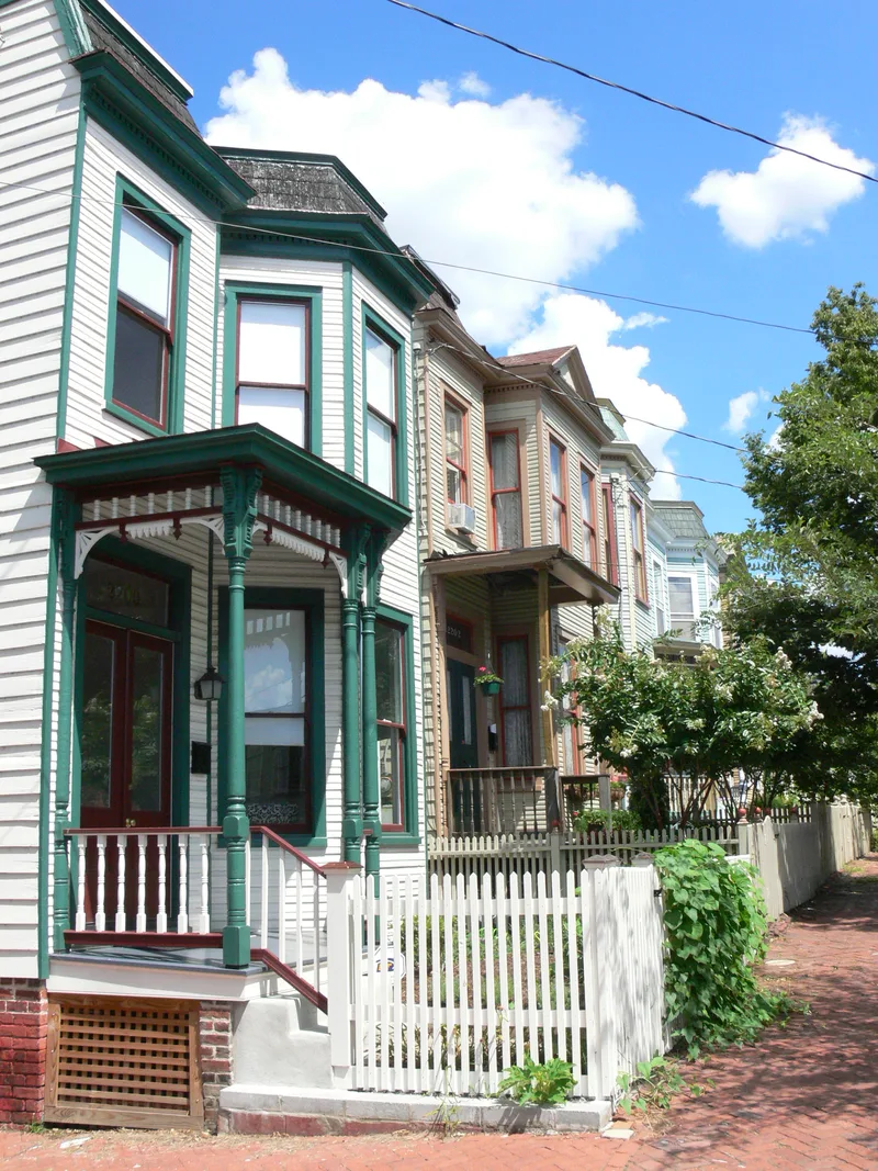
Union Hill is a residential neighborhood in Richmond's east end, set on hills once cut off from the rest of Church Hill by a deep ravine and the bluffs above Shockoe Valley. Laid out in 1805 by John Adams and Benjamin Mosby, its streets bend and climb with the terrain instead of following the city grid, producing odd triangular blocks. The district holds 369 buildings and a park, mostly modest frame and brick houses for tailors, tanners, carpenters and other working families. Many predate the 1867 annexation from Henrico County. Greek Revival houses and cottages dominate the antebellum period, followed by Italianate and Late Victorian dwellings and several Romanesque and Gothic churches along Venable Street. Street grading left many houses perched on raised foundations. Dozens of antebellum buildings have been demolished and abandonment remains a concern, yet the neighborhood keeps a high level of integrity and a distinctive sense of its historic setting.
Significance in brief: The district preserves a neighborhood of modest working-class frame and brick houses, many built before 1867, in Greek Revival, Italianate and Late Victorian styles. Its irregular street pattern, shaped by steep terrain and ravines, gives it a character found nowhere else in the city. Despite demolitions, the form states it retains a high level of integrity and conveys its historic environment.
Machine-generated summary. This summary was generated by a language model from the official nomination document and has not been reviewed line by line by an editor. It may contain errors. Check the source document before relying on any detail. Source: nomination document (PDF) · National Archives catalog entry. NRHP reference 02001670, listed December 31, 2002. Summary generated October 2026 (model claude-sonnet-5-5, prompt v1.0-2026-10-29, confidence medium).
Key facts
| Address | Roughly 20th, 21st, 22nd, 23rd, 24th 25th, Jessamine, Pink, Burton, Carrington, Cedar, Clay, Jefferson, Leigh, M, O, Sts, Richmond (Independent City) |
|---|---|
| County | Richmond (city and county) |
| Listed | December 31, 2002 |
| Reference number | 02001670 |
| Resource type | District |
| Architectural style | Federal, Greek Revival, Italianate, Queen Anne, Classical Revival, Art Deco |
| Areas of significance | Architecture, Social History |
| Level of significance | Local |
| Status (as stated in the nomination) | Described as a fragile neighborhood suffering from abandonment and neglect; 39 houses were lost since a 1993 survey, though it retains a high level of integrity. |
| Coordinates | 37.53779, -77.41970 (NPS GIS) |
What listing means for this property
This is a historic district. Buildings within its boundary are either contributing (they add to the district's significance) or non-contributing. Owners of contributing income-producing buildings can claim the 20% federal rehabilitation tax credit; homeowners should look at state credits. National Register districts impose no design review by themselves; a local historic district ordinance, if one exists, does (the difference explained).
General information, not legal or tax advice. Rules change; confirm with your State Historic Preservation Office or a qualified adviser.
Sources and further reading
- National Park Service, National Register of Historic Places database (snapshot May 2026), reference 02001670.
- Nomination form (PDF, National Archives) — catalog entry
- Wikipedia article (used for cross-checking only; text not reproduced here)
- Wikidata Q7885760
- This listing as JSON
Last updated October 2026. Found an error? See the editorial policy for how to report it.