Massanutton Heights

Why it's listed
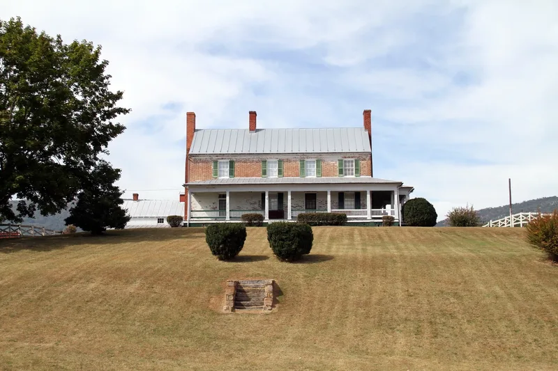
Massanutton Heights is a brick farmhouse on a knoll near Luray, overlooking Massanutton Old Fields, one of the earliest settled areas of Page County. John R. Burner and his wife Elizabeth Strickler probably built it around 1820, and Burner received a tavern license in 1831. The two-story house is laid in Flemish bond and has a three-room, single-pile plan. Its central parlor carries early painted decoration: imitation wainscoting, a border of flowers and vines, and red swag draperies with gold fringe and tassels, imitating the border papers of fine Federal houses. The Burner family took boarders from the 1920s to the 1940s and added a frame ell in 1924. Surviving outbuildings include a tenant house, wash house, wagon shed and a gambrel-roofed bank barn. The 144-acre farm is valued as a nearly undisturbed Shenandoah Valley farmstead that shows how German-American settlers lived.
Significance in brief: It is described as an essentially undisturbed example of a prosperous early nineteenth-century Shenandoah Valley farmstead. The first-floor parlor has rare early painted wall decoration, a surviving example of popular art of the period. Together with the bold provincial woodwork, family artifacts and farm buildings, it shows the material culture of German-American settlers in the Valley.
Machine-generated summary. This summary was generated by a language model from the official nomination document and has not been reviewed line by line by an editor. It may contain errors. Check the source document before relying on any detail. Source: nomination document (PDF) · National Archives catalog entry. NRHP reference 76002117, listed July 30, 1976. Summary generated October 2026 (model claude-sonnet-5-5, prompt v1.0-2026-10-29, confidence high).
Key facts
| Address | W of Luray on U.S. 211, Luray |
|---|---|
| County | Page County |
| Listed | July 30, 1976 |
| Reference number | 76002117 |
| Resource type | Building |
| Architect / builder | John R. Burner (probable builder) |
| Areas of significance | Art, Architecture, Agriculture |
| Level of significance | State |
| Status (as stated in the nomination) | Occupied private residence; the farm is still owned by the family that established it. The painted parlor decoration is in excellent condition and apparently has not been retouched. |
| Acreage | 144 |
| Coordinates | 38.63764, -78.56866 (NPS GIS) |
What listing means for this property
National Register listing is honorary: it recognises significance and does not restrict what a private owner may do without federal money or permits. It unlocks the 20% federal rehabilitation tax credit for income-producing buildings, state credits in many states, and Section 106 review when federal agencies are involved. See what listing means in practice.
General information, not legal or tax advice. Rules change; confirm with your State Historic Preservation Office or a qualified adviser.
Sources and further reading
- National Park Service, National Register of Historic Places database (snapshot May 2026), reference 76002117.
- Nomination form (PDF, National Archives) — catalog entry
- Wikipedia article (used for cross-checking only; text not reproduced here)
- Wikidata Q15250664
- This listing as JSON
Last updated October 2026. Found an error? See the editorial policy for how to report it.