West Point Cemetery
Also known as: DHR File# 122-5181; Potter's Field; Calvary Cemetery

Why it's listed
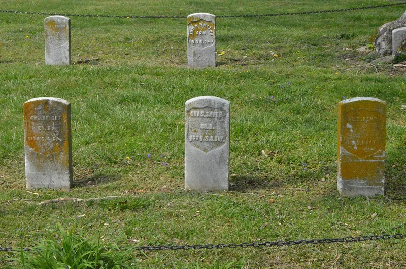
West Point Cemetery occupies about fourteen acres in downtown Norfolk, Virginia. A ten-foot brick wall separates it from the white Elmwood Cemetery. The city designated the land as a burial ground for African Americans in 1873 after the Black community pressed for a public cemetery, and it was long called Potter's Field. In 1885 councilman and Union veteran James E. Fuller proposed the name West Point and secured a section for Black Union veterans. That section holds 58 Civil War soldiers and sailors in three rows. A bronze statue of a Union soldier, modeled on Sergeant William H. Carney of the 54th Massachusetts, stands over them. Fundraising by Fuller and many community groups took decades, and the monument was finished in 1920. A plaque honors Spanish-American War soldiers. The grounds also include a cluster of 55 early headstones, family plots with marble and brick borders, and an 1876 brick mausoleum. The form describes it as the only known memorial in the South to Black veterans of both wars.
Significance in brief: The nomination argues the cemetery shows Black Norfolk residents using newly acquired political power during Reconstruction to secure a public burial ground. It holds the graves of 58 Black Civil War soldiers and sailors, marked by a monument completed in 1920 after decades of fundraising. The form calls the monument the only known memorial in the South to Black veterans of the Civil and Spanish-American wars.
Machine-generated summary. This summary was generated by a language model from the official nomination document and has not been reviewed line by line by an editor. It may contain errors. Check the source document before relying on any detail. Source: nomination document (PDF) · National Archives catalog entry. NRHP reference 07000393, listed May 3, 2007. Summary generated October 2026 (model claude-sonnet-5-5, prompt v1.0-2026-10-29, confidence high).
Key facts
| Address | 238 E. Princess Anne Rd., Norfolk (Independent City) |
|---|---|
| County | Norfolk |
| Listed | May 3, 2007 |
| Reference number | 07000393 |
| Resource type | District |
| Period of significance | 1843-1920 |
| Architect / builder | O'Rourke (mausoleum mason) |
| Architectural style | Other: Cemetery |
| Criteria |
|
| Areas of significance | Black, Social History |
| Level of significance | Local |
| Status (as stated in the nomination) | Still used as a cemetery; the O'Rourke mausoleum is badly deteriorated and the city has posted a sign warning trespassers not to enter. |
| Acreage | 14 |
| Coordinates | 36.86155, -76.28492 (NPS GIS) |
What listing means for this property
This is a historic district. Buildings within its boundary are either contributing (they add to the district's significance) or non-contributing. Owners of contributing income-producing buildings can claim the 20% federal rehabilitation tax credit; homeowners should look at state credits. National Register districts impose no design review by themselves; a local historic district ordinance, if one exists, does (the difference explained).
General information, not legal or tax advice. Rules change; confirm with your State Historic Preservation Office or a qualified adviser.
Sources and further reading
- National Park Service, National Register of Historic Places database (snapshot May 2026), reference 07000393.
- Nomination form (PDF, National Archives) — catalog entry
- Wikipedia article (used for cross-checking only; text not reproduced here)
- Wikidata Q16903096
- This listing as JSON
Last updated October 2026. Found an error? See the editorial policy for how to report it.