Rock Hill Farm
Also known as: VDHR File No. 053-1057

Why it's listed
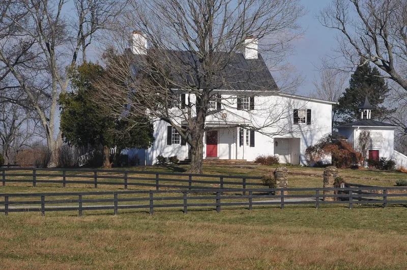
Rock Hill Farm is a 68.8-acre farm in the rolling northern Virginia piedmont, near Bluemont in Loudoun County. Its main building is a two-story, stucco-covered fieldstone house built in 1797 on a Quaker plan, with a wide hall and two smaller rooms. Additions were made around 1873, 1902, 1947 and 1990, yet the interior keeps nearly all of its original woodwork and door hardware. The hall's paneling and chimneypiece blend Georgian and Federal details. Around the house stand a bank barn, smokehouse, garage, corncrib, dairy and run-in shed from the 1797 and 1873 building phases, along with dry-laid fieldstone fences and the remains of a boxwood garden. A small cemetery from about 1820 holds a marble marker for a fifteen-year-old girl and three fieldstone-marked graves. The farm was listed for its architecture, with a period of significance running from 1797 to about 1950.
Significance in brief: The nomination argues the property is significant under Criterion C for architecture. The 1797 Quaker-plan house retains nearly all of its original woodwork and hardware, showing a transition from Georgian to Federal styles. Later additions and outbuildings document the farm's evolution through about 1950.
Machine-generated summary. This summary was generated by a language model from the official nomination document and has not been reviewed line by line by an editor. It may contain errors. Check the source document before relying on any detail. Source: nomination document (PDF) · National Archives catalog entry. NRHP reference 09000664, listed August 27, 2009. Summary generated October 2026 (model claude-sonnet-5-5, prompt v1.0-2026-10-29, confidence medium).
Key facts
| Address | 20775 Airmont Rd., Bluemont |
|---|---|
| County | Loudoun County |
| Listed | August 27, 2009 |
| Reference number | 09000664 |
| Resource type | District |
| Period of significance | 1797-ca.1950 |
| Architectural style | Early Republic: Federal |
| Criteria |
|
| Areas of significance | Architecture |
| Level of significance | Local |
| Status (as stated in the nomination) | Still used as a single dwelling with agricultural outbuildings and a cemetery; the formal garden survives only as remains, and the fieldstone fences are in slight to moderate disrepair. |
| Acreage | 68.8 |
| Within district | Unison Battlefield Historic District |
| Coordinates | 39.04506, -77.82968 (NPS GIS) |
What listing means for this property
This is a historic district. Buildings within its boundary are either contributing (they add to the district's significance) or non-contributing. Owners of contributing income-producing buildings can claim the 20% federal rehabilitation tax credit; homeowners should look at state credits. National Register districts impose no design review by themselves; a local historic district ordinance, if one exists, does (the difference explained).
General information, not legal or tax advice. Rules change; confirm with your State Historic Preservation Office or a qualified adviser.
Sources and further reading
- National Park Service, National Register of Historic Places database (snapshot May 2026), reference 09000664.
- Nomination form (PDF, National Archives) — catalog entry
- Wikipedia article (used for cross-checking only; text not reproduced here)
- Wikidata Q14713149
- This listing as JSON
Last updated October 2026. Found an error? See the editorial policy for how to report it.