Oatlands Historic District
Also known as: See Also:Oatlands

Why it's listed
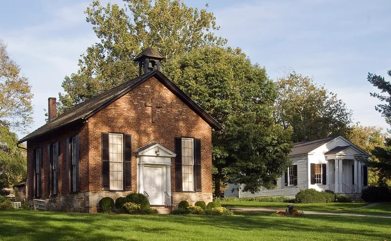
Southwest of Leesburg, this 947-acre district in Loudoun County extends the setting of George Carter's Oatlands plantation. Earlier protection covered the main house and about 300 acres; later gifts and easements tripled the area to preserve the open landscape. Three sites are described. Oatland Mills, on Goose Creek, survives as stone and brick fragments and traces of the mill race. A surviving ledger from 1816 to 1825 records Carter's milling and other services, and the mill was destroyed about 1905. Mountain Gap School is a small red one-room building, apparently from the late nineteenth century, and was the last operating one-room school in the county when it closed in 1953. The Church of Our Savior, an Episcopal brick church consecrated in 1878, keeps a gallery above its west entrance. Together they formed a small crossroads community and show how the plantation operated.
Significance in brief: The expansion brings in lands and structures historically tied to Carter's plantation, creating a contiguous and visually integrated landscape. The mill site documents Carter's business operations and a small crossroads community. The school was the last operating one-room school in Loudoun County, and the church reflects the local rural community of the late 1800s.
Machine-generated summary. This summary was generated by a language model from the official nomination document and has not been reviewed line by line by an editor. It may contain errors. Check the source document before relying on any detail. Source: nomination document (PDF) · National Archives catalog entry. NRHP reference 74002327, listed May 3, 1974. Summary generated October 2026 (model claude-sonnet-5-5, prompt v1.0-2026-10-29, confidence medium).
Key facts
| Address | S of Leesburg off U.S. 15, Leesburg |
|---|---|
| County | Loudoun County |
| Listed | May 3, 1974 |
| Reference number | 74002327 |
| Resource type | District |
| Areas of significance | Landscape Architecture, Commerce, Agriculture, Historic - Non-Aboriginal, Architecture |
| Level of significance | State |
| Status (as stated in the nomination) | Condition is stated as excellent and unaltered. The mill is a ruin of foundations and fragments; the school is a museum; the church is an active congregation's building. |
| Acreage | 947 |
| Coordinates | 39.03935, -77.62257 (NPS GIS) |
What listing means for this property
This is a historic district. Buildings within its boundary are either contributing (they add to the district's significance) or non-contributing. Owners of contributing income-producing buildings can claim the 20% federal rehabilitation tax credit; homeowners should look at state credits. National Register districts impose no design review by themselves; a local historic district ordinance, if one exists, does (the difference explained).
General information, not legal or tax advice. Rules change; confirm with your State Historic Preservation Office or a qualified adviser.
Sources and further reading
- National Park Service, National Register of Historic Places database (snapshot May 2026), reference 74002327.
- Nomination form (PDF, National Archives) — catalog entry
- Wikidata Q49534548
- This listing as JSON
Last updated October 2026. Found an error? See the editorial policy for how to report it.